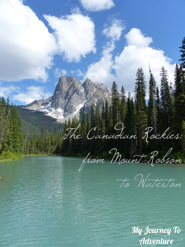
|
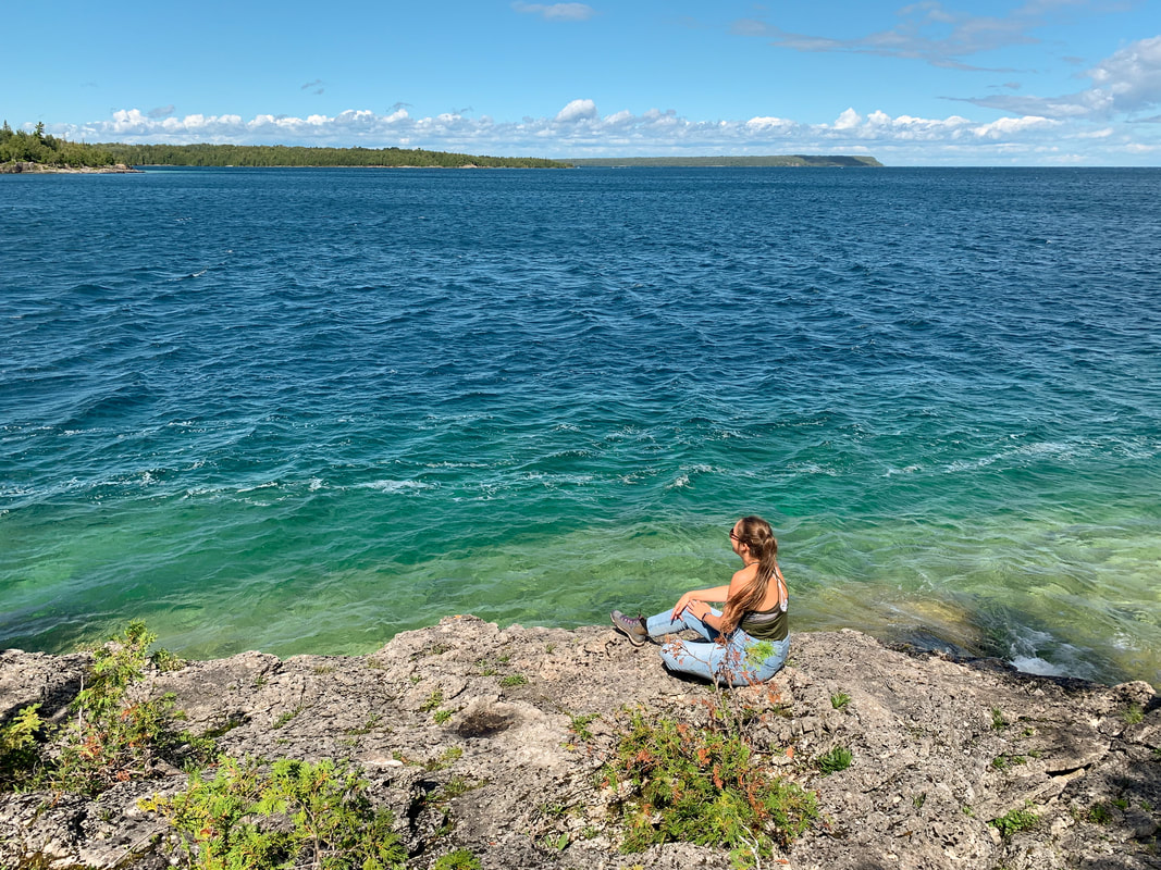
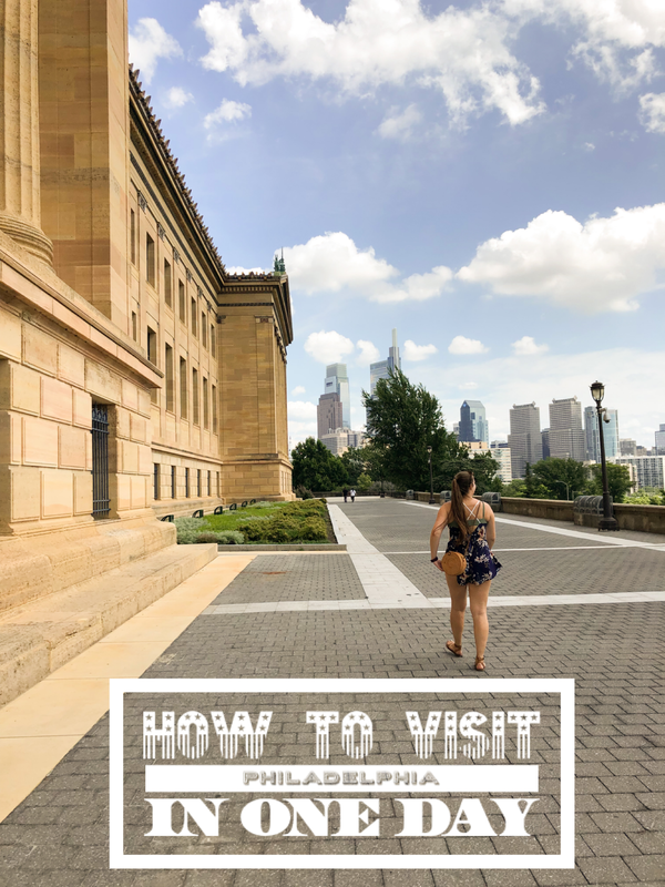
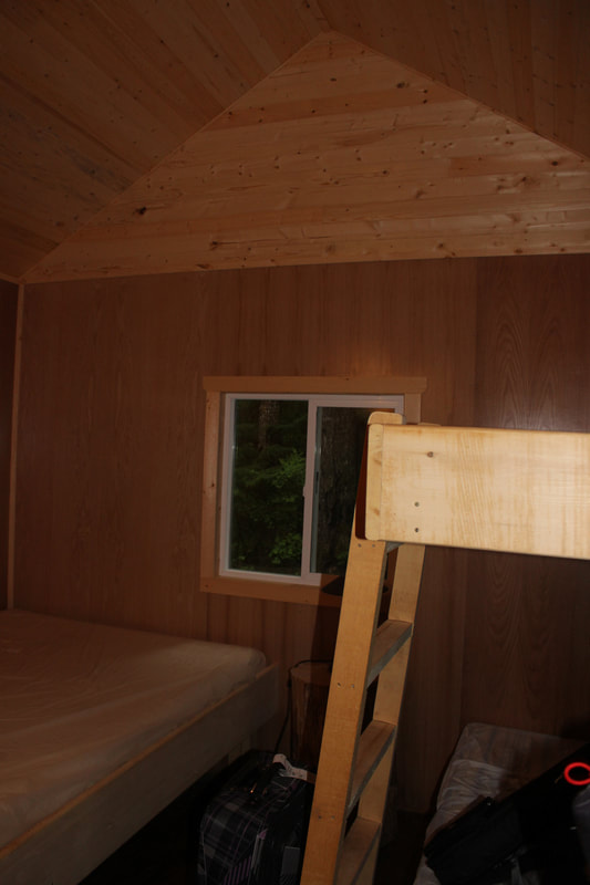
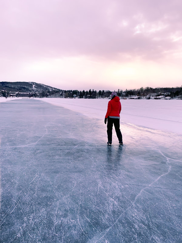
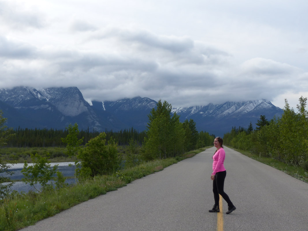
I'm going to be very honest here: I made a lot of mistakes on my trip to Acadia National Park. Unfortunately for me, all of those mistakes were due to me not having a lot of time to research and going in unprepared, it had very little to do with the destination. Lucky for you, I listed all the things I wish I had known, so you don't have to do the same mistakes I did. 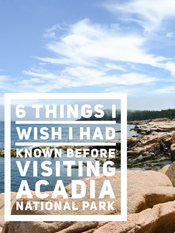 you can and will drive into the park without seeing the visitor centerThere are multiple entrances into Acadia National Park and none of them drive by the Visitor Center. It is very out of the way, and you have to actually aim for it, otherwise, you might go through your whole visit without seeing it. Usually, when visiting national park, visitor centers are my first stop. I love them! There is always a fun museum sort of gallery with information about the area and the animals that live there, or the history of the park. You can find all sorts of information and you can talk to a park ranger and find out the best way to make the most of your visit according to your interests. Since the visitor center is nowhere near any of the attractions, it made no sense to do a detour for it and the only reason we even went was because I was done looking for parking spaces. If only we had gone there at the beginning of our stay! 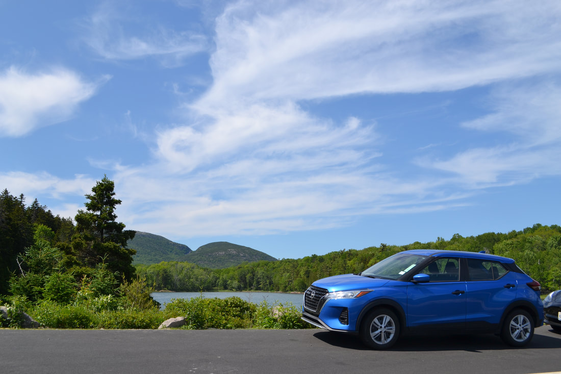 parking spaces are limited in the parkWether you are getting ready for a hike or looking forward to a lazy day at the beach, finding a parking spot might be a bit of a hassle. We spent the first few days of our visit really struggling to find parking spots before giving up and heading toward the visitor center and discovering there are actually buses that you can take for free that will take you to any spot you want around the park! We visited during the first weekend of summer and, I guess the signs weren't up yet, but we had no idea there was a shuttle service at the park. It wasn't on any of the park documentation we were given at the campground. If we had known, we wouldn't have bothered trying to find parking and would just have taken the bus everywhere! 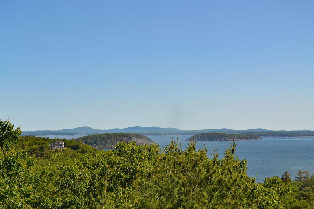 hiking maps are for sale or available onlineThis one really bothered me, not because it was a huge problem, but for the principle of it. So basically, you could get a map of the park for free, but that map shows mostly the attractions, main roads and some trails, but it doesn't say the distance or altitude or the difficulty level... If you want the actual "hiking map", it is available for purchase for 5$. Don't get me wrong, 5$ is nothing, but it felt cheap. Also, not knowing the distances or difficulty level can be an actual problem. People can get stuck on trails that are way too advanced for them because they had no idea it was technical in the first place. So, since the hiking map is available on the Acadia website, I recommend printing it out before heading there. That way you can make better decision on what trail to hike depending on your fitness level or you can prepare snacks, water and the right footwear according to the difficulty of the trail you want to hike. 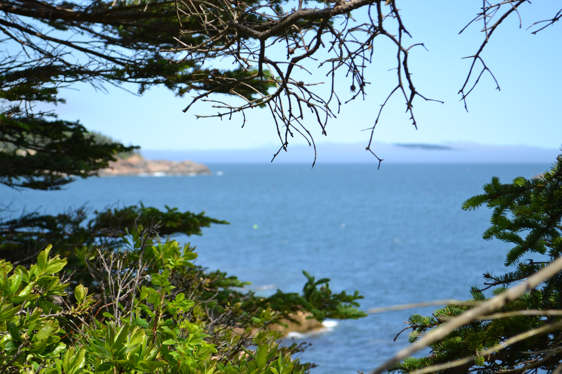 short hike doesn't mean easy hikeWe found out the hard way (because we did not buy the hiking map and had no wifi) that the shorter the hike, the steepest it will be. From what we saw, most hikes head up and down mountains, so a shorter hike means it is not zigzaging up the mountain, but heading straight up. Just thought you should know ;) 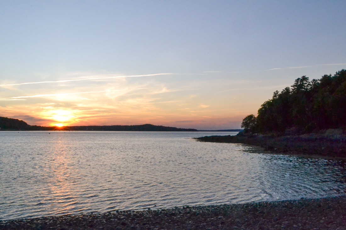 you absolutely need a reservation to go to cadillac mountainIf you have seen pictures or articles about Acadia National Park before, they were probably about Cadillac mountain. It is the highest peak in the park and has a 360 degree view which makes it a great sunrise and sunset spot. It apparently also makes it a very popular spot at every hour of the day and night. We made our way there very early in the morning to find out you absolutely need a reservation and it was booked out for the whole week... We had no idea we needed a reservation, let alone a reservation far in advance. Luckily, there are other mountains, and the sunrises and sunsets are beautiful from any view point, but if going to the top is on your list of must-dos, make sure to reserve in advance. 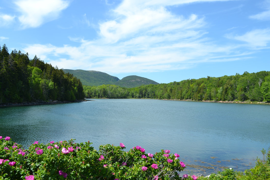 it can be very crowded even in shoulder seasonWe visited during St-Jean Baptiste which is a holiday in the province of Quebec, but isn't in the United States, so it wasn't a long weekend. It's also at the very beginning of summer, as school had just ended that week so I expected the park to be busy, but never even thought it could be crowded already. There were people everywhere. At the beach, at trail ends, in every street in Bar Harbor, on the rocks at random lookouts, everywhere! Even hiking in the rain we met some people! I don't think it would have bothered me so much if I had known, but I was expecting a quiet, tranquil weekend in nature and got... a theme park. Not what I had in mind! 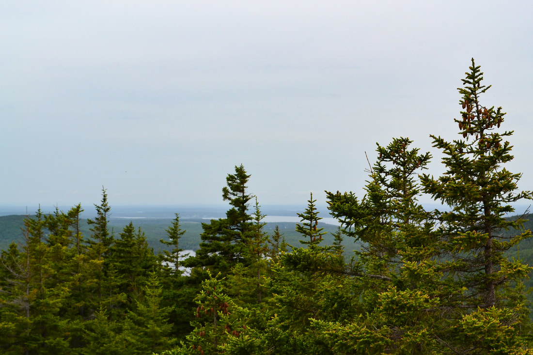 In the end, I did end up liking the destination. The park has beautiful scenery and the hikes were fun, but I feel like my own ignorance prevented me from fully appreciating the experience. I really hope I get the chance to go back one day and do it right! Luckily, it is only a short drive from my home in Quebec City. other articles that might interest you
0 Comments
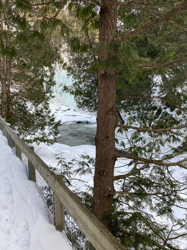
It is no secret that Canada has beautiful winters and that the province of Quebec receives a lot of snow in the winter, but there are places in Quebec that receive just a little bit of extra powder and the Parc National des Monts-Valin is one of those places. Actually, the Ghosts Valley or, Vallée des fantômes, is the place where it snows the most in the whole province, receiving an average or 3 meters of snow each year. This amount of snow offers peak conditions for winter activities such as snowshoeing and cross-country skiing and some of the most beautiful views.
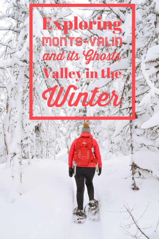
how to get to the ghosts valley
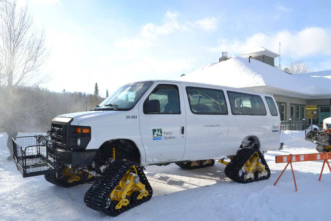
To get to the Ghosts Valley, you need to catch a ride on one of these bad boys pictured below. These mini buses equipped with snowmobile tracks are the only way to make it up the mountains in the winter. If you are lucky, you can make a reservation to stay overnight at one of the cabins available here, but if you aren't able to make a reservation for a cabin, you can still make a reservation for the shuttle. Try to book in advance because there are limited places and they often sell out months in advance.
my experience snowshoeing in the ghosts valley
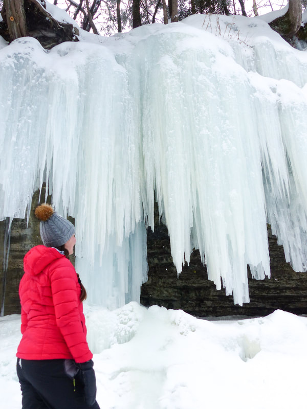
I'm not going to lie, on the day that we visited, it was freezing cold. I mean -20 degrees, windy, my breath froze on my hair cold. But in the valley, where you are hidden from the wind, it really wasn't so bad and, to be honest, I was so amazed by the view and the amount of snow on the trees that it took me a while to even feel the cold.
The trail, from where the bus drops you off, is 2 km to a small cabin where you can go to warm up or eat a snack, and an additional 1 km to the summit. So basically, 6 km total. The trail is always uphill all the way to the summit, but most of the way it's not a very steep hill. It will be a challenge, but is attainable to anyone moderately active in my opinion. Most of the people that were there on this week day were retired and over 60 years old and, though they looked in fairly good shape, I don't think they trained for this hike. Honestly, I have hiked way longer trails and some that were way steeper, but it was still a challenge for me. I am not used to wearing snowshoes and they are pretty heavy. The cold also made it harder to breath and made me tire more quickly than usual. Still, I have no regrets visiting and absolutely enjoyed the whole day. It just made me appreciate the cabins and fireplaces a little bit more! The pictures really don't do it justice! The whole hike was beautiful! 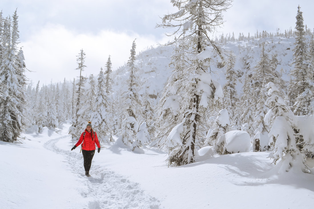
where to stay
If you can, try and rent a cabin directly at the park. If you can stay for 2 nights, that means you get a full day of playing in the heavy snow and the opportunity to see the sunrise or sunset.
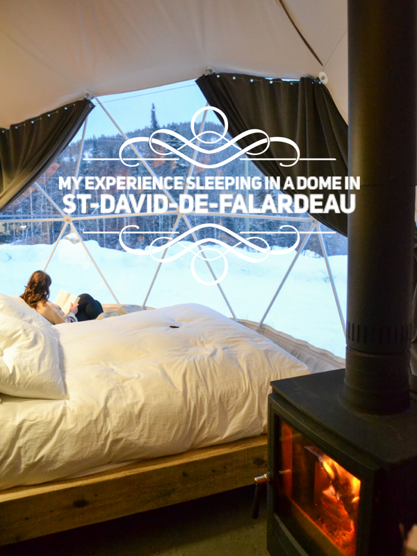
If you can't manage a reservation directly at the park, make sure to make a reservation for accommodation close by as you have to arrive pretty early for the shuttle. Personally, we stayed in St-David-de-Falardeau in a dome that you can check out here and it was the perfect distance. We were a 15-minute drive away. There are also plenty of hotels in Chicoutimi, which would be a 30-minute drive form the park, but you'll find a wider range of options and more affordable prices there. 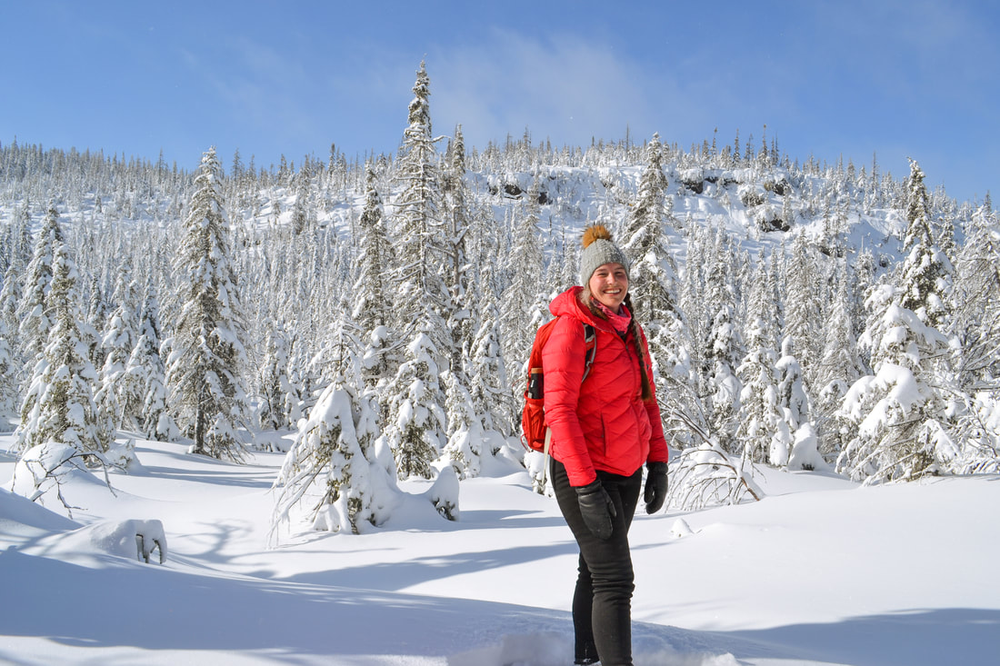
what to bring
Warm clothes! I can't say this enough! Of course, you should check the weather and plan accordingly, but plan to bring extra layers and extra clothing so you can change when you get to the cabin and don't have to wait for the shuttle in humid clothes.
I also recommend bringing a lunch. We had to be at the park for 8 AM for our 8:30 shuttle and it was picking us back up at 2:30 PM so I was glad we had packed a sandwich and plenty of snacks. Also think about bringing water in a thermos or very well insulated bottles so your water doesn't freeze mid-hike. You need to bring your own snowshoes or cross-country skis or rent them at the park entrance. If you don't own any, make sure to plan ahead. If you are like me and enjoy taking pictures of your adventures, this is going to be a challenge for you. I had brought two batteries for my camera and both died before we even reached the summit because of the cold. I had to wear them in my mittens so they would warm up and work again for about five minutes. Same with our cellphones, they both kept dying from the cold. Make sure you keep your electronics in your coat and close to you so they last long enough for you to get good pictures of the hike. 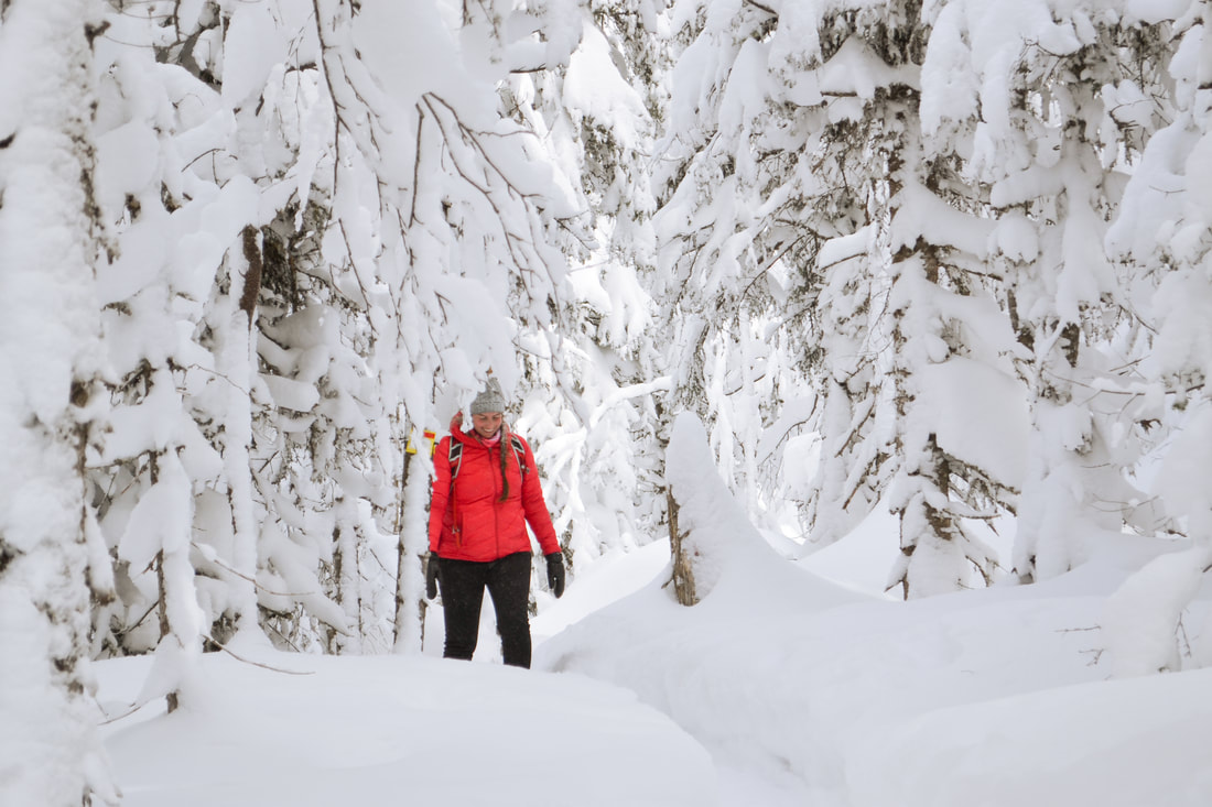
why you need to visit
I think the pictures pretty much speak for themselves. Wether you are from the area or visiting Quebec on a short trip, this will impress you. It is one of those pretty short and attainable hikes that have a very good effort vs views ratio. Even though it might be a challenge, you will still love every minute and appreciate every single turn around the bend.
In my opinion, it is a bucketlist hike that everyone will love and should do at least once in their life! 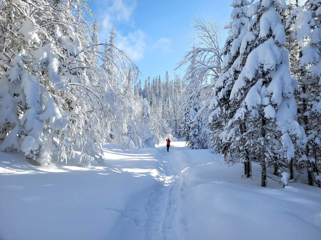
This trail is all of the reasons that I love hiking so much all wrapped into one. It has a little bit of challenge, a lot of views, a similar minded group of people and limited access so it's never crowded, a nice place to have lunch and warm up in case of inclement weather and the pleasure of being outside in nature. What more could you ask for?
other articles you might enjoy
10/2/2023 0 Comments THE 3H HIKE IN TELEGRAPH COVE
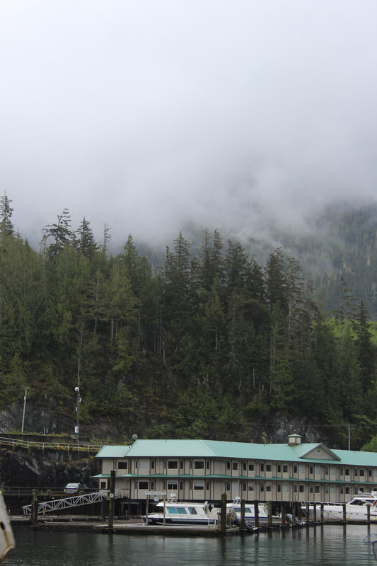
The check-in process was very simple and the employees at the campground were very nice. We then asked what there was to do in the area and the man told us of a free hike that starts on the campground and is about 3 hours long. Apparently there is a nice lookout about mid-way and the trail leads to a beach where you can see whales. It seemed perfect!
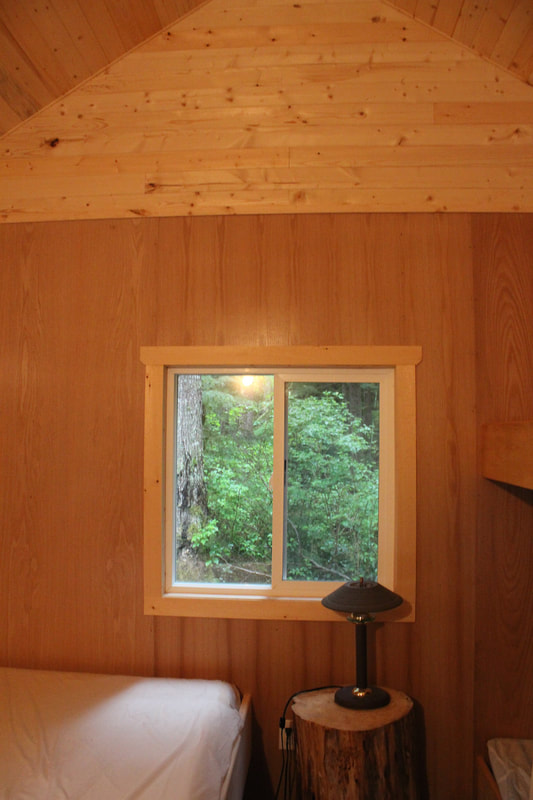
So we had a good night in our small cabin with the rain lulling us to sleep and woke up the next morning ready for this 3-hour hike. We put on our training shoes, grabbed a bottle of water and got on our way.
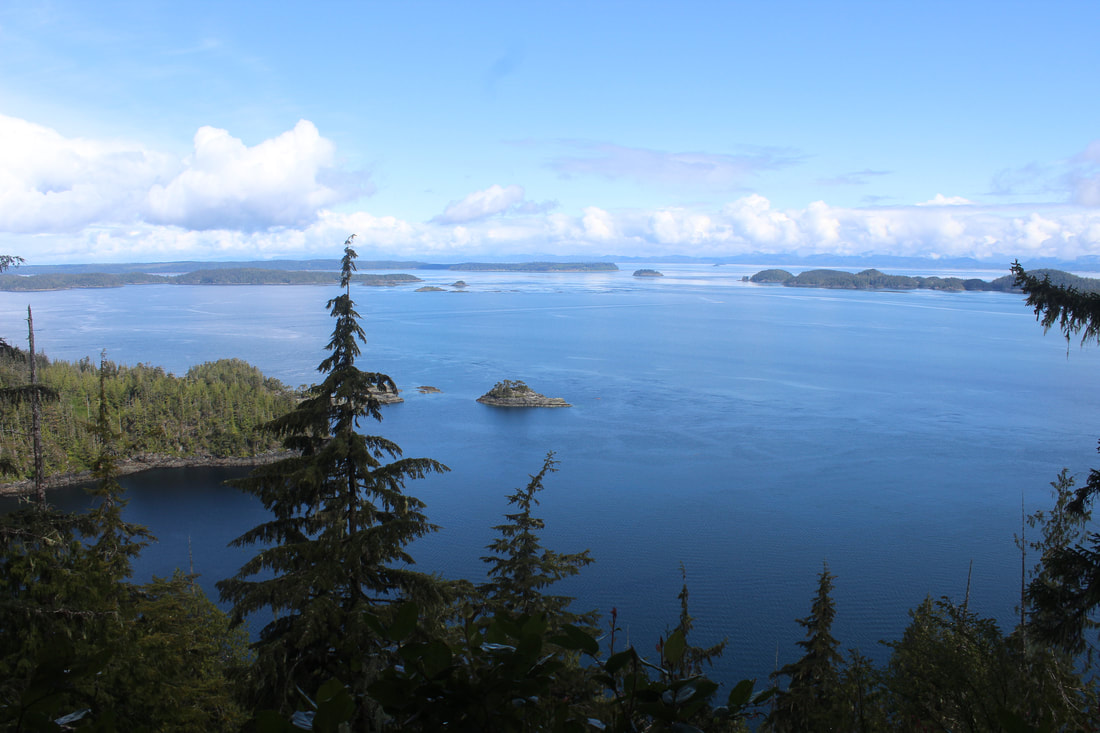
The trail was pretty muddy because of the rain, but the weather that day was nice and it wasn't a very difficult trail until we got to the lookout. To get there, we had to hike a pretty much vertical trail to the side of the main trail. It was muddy and slippery and the whole time I was climbing I was just wondering how I was going to get down later. Fortunately, it wasn't a long way to the lookout where we had an amazing point of view on the Strait of Georgia and the British Colombia mainland. It was so beautiful! By that point, we had been hiking for about an hour so we decided to keep going to the beach.
Getting down from the lookout was thankfully uneventful. We took our time and it was easier than expected. But from the lookout, the trail to the beach just got more difficult. The trail wasn't as clearly marked and we had to keep looking out for blue dots on the trees to make sure we were still on the trail. It just kept going up and down and up again, over fallen tree branches and between boulders, holding on to ropes and crossing tiny rickety bridges. Every time we saw the ocean through the trees we thought we were almost there only for the trail to turn back inland and keep going.
After two hours of hiking, we thought we had to be close. After all, the hike was supposed to take 3 hours to the beach and back! The three of us were almost out of water, we were getting tired, it was harder and harder to spot the blue dots and we had to push away branches to clear the way. Let's just say the further we got the more it became clear that most people just turned around before reaching the beach.
Finally, after over two and a half hours of hiking, we reached the beach to find the rocks covered in slippery alguae and crowded with tiny crabs. After falling down, hurting myself and coming face to face with a crab, I didn't really feel like sticking around, whales or no whales. So after all of this effort, we just walked back to camp defeated.
We made it back after a little bit over five hours of hiking, completely dehydrated, so hungry that we didn't even feel the hunger anymore, and ready for a shower and some sleep. Back then, I was in pretty good shape and used to walking a lot during my travels, but I hadn't done much hiking, I didn't own a pair of hiking boots and I wasn't used to bringing snacks and extra water, just in case. This hike definitely changed my perspective, and now, I make sure I know all of the information on the trail (the length, the difficulty level, the incline, etc) before I start. I also make sure I bring a change of clothes, a first-aid kit and enough sustenance to survive about twice the distance I am about to take on. I would never leave for an unknown trail with just a bottle of water and my car keys like I did that time and, every time my friends and I put on our backpacks, we joke about how we'll never get caught without equipment like we did in Telegraph Cove.
That day, after having a later lunch than planned and finally sitting down, we figured the guy probably said it was a three hour-hike to the beach and we misunderstood, or it was a three hour-hike to the lookout and back. Who knows what he meant, but he definitely did not mean that it would be a three hour-hike to the beach and back that's for sure!
For more information on the places we visited on Vancouver Island, click here.
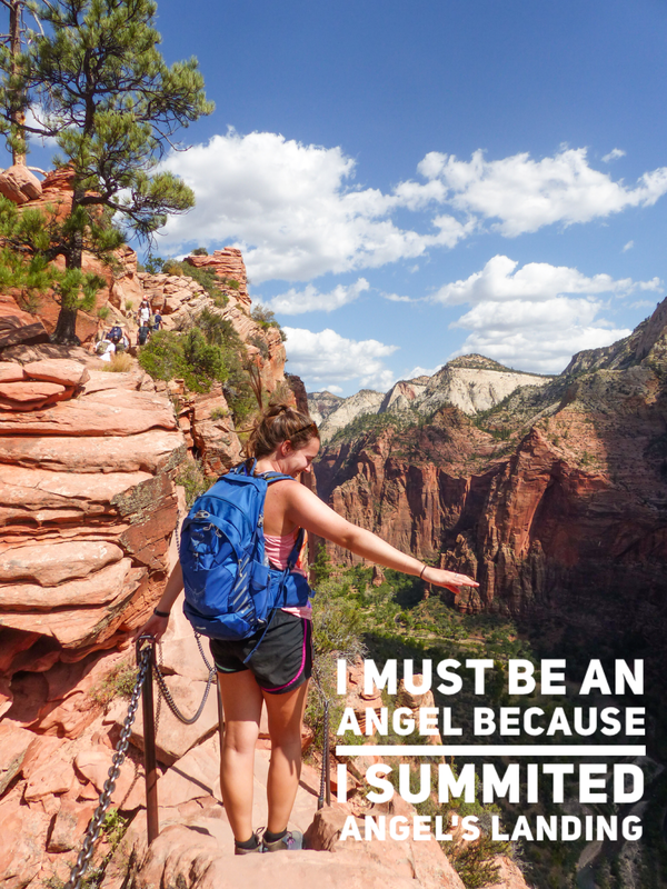
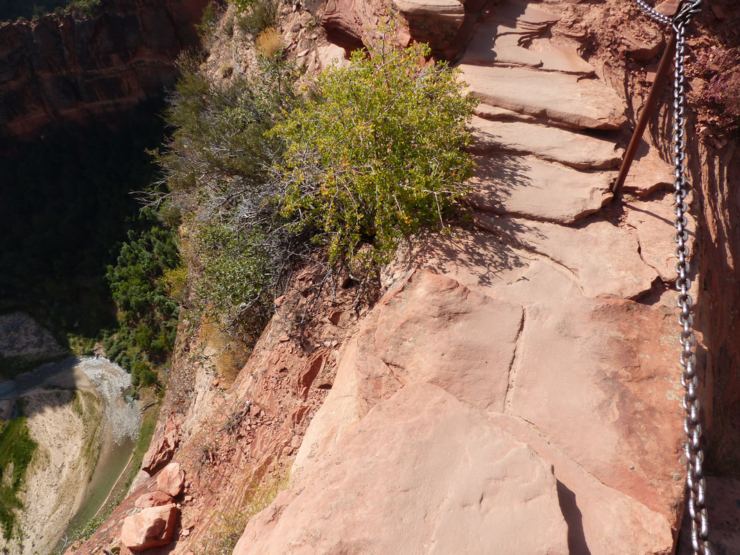
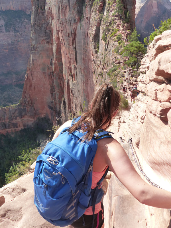
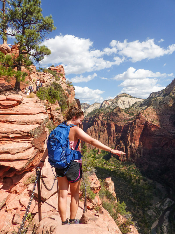
Angel's Landing is one of the most popular hikes in the United States and is located in Zion National Park. You might have already seen photos and videos of people holding on the chains to hike the narrow trail to its summit. When my friend and I visited Zion on our road trip through the American Southwest, we were a little intimidated by this trail that. is rated very difficult. We are both healthy and pretty active, but we are not the type of people who train everyday at the gym or who run marathons. This trip was also pretty last minute, so we didn't have time to train for it. Let's just say we decided we were going to try it, but made the deal that at any point if one of us decided we were done, we were going to turn around and go back down and there would be no shame in it.
We planned our hike to give ourselves the best chance and started early in the morning so we would be in the shade for as long as possible and the heat would be less of a challenge. When we visited in September 2019, it was about 33 degrees Celsius in the afternoon.
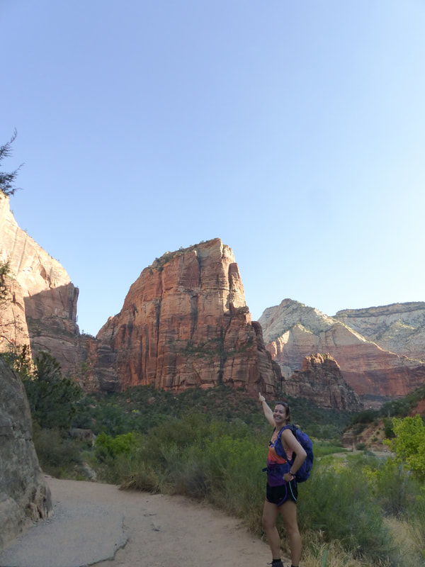
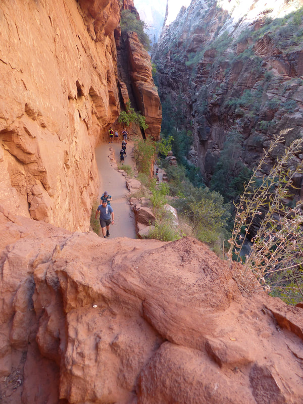
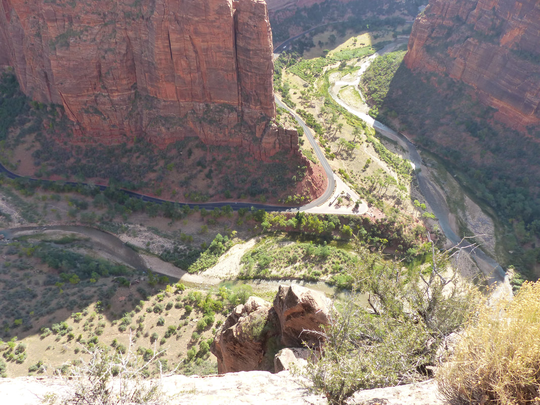
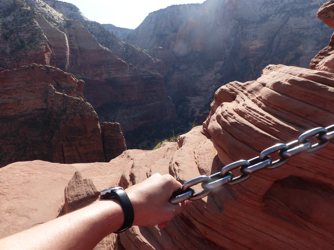
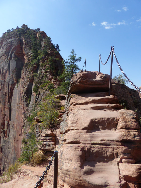
This hike can be split in three sections. The first part is made of switch backs all the way up the vertical face of the mountain to the area where two mountains split that you can see on the picture above. Then you arrive to the section called Walter's wiggles, another section of switchbacks that are tighter and steeper that you can see on the picture below. And finally, the summit, where you have to hold on to chains and walk by the cliff on both sides.
Personally, I think the first part of switchbacks was the worst. It seemed infinite and we were in the sun for the most part so it was very hot. Usually when you hike a mountain, you will be going up and then the trail will go down a little bit and then up again and keep switching all the way up the mountain. Angel's Landing isn't like that. It's just up all the way to the summit and although the switchbacks aren't very steep, they give you no respite. You can stop at any point for a break and there is plenty of space for people to pass you if needed in that part, but it is rough on cardio and on your legs.
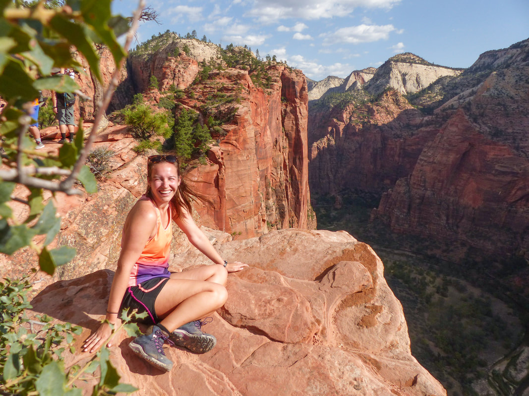
Once you are done with all the switchbacks and reach the summit section, it is more technical, but it gets easier in my opinion. Your mind is fully on planning where your next step should be instead of how out of breath you are. It also gets so beautiful that you are just blown away by it and grateful that you get the chance to see this view.
In this part, there is no rush. You take your time and if people want to pass you or if you want to pass other people, it can wait for a larger part of the trail where it is safe. Honestly, most people were very nice while we were there. Super respectful of others' limits and helping each other. Of course there were also people without water and hiking in flip flops, but what can you do...
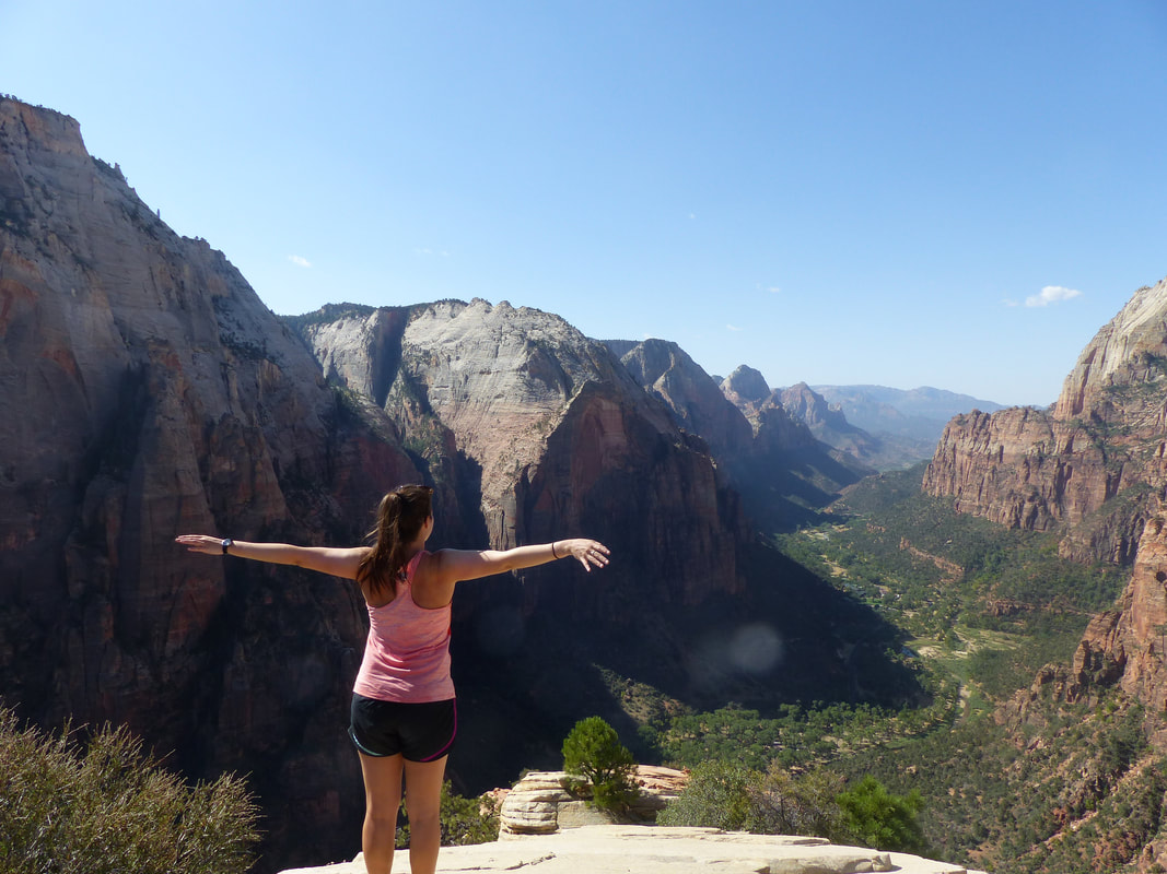
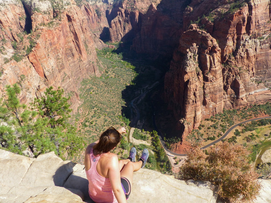
When you reach the summit, you get a 360 degree-view on the whole valley and it blows your mind. It's been years and this is still my favorite hike ever, not only because I am proud that I reached the summit, but because the view was incredible. You feel like a bird flying through the valley and the feeling is indescribable.
We took our time on the summit, had a quick lunch and then slowly made our way back down. The switchbacks are still killer on the way down, but at least you are not as out of breath.
All in all, it took us approximately 3 hours for the hiking part and we took a small break before the summit and stopped for a long while on the summit. I would say from the time we stepped off the bus to the time we stepped back on, about 4 hours.
I seriously recommend doing this hike if you are able. It was easier than I thought it would be, but still a big challenge for me. I think if you are used to hiking mountains you can do it, but the heat and the switchbacks will be rough. The chains part was also more technical than I was used to, but it's not slippery so it wasn't that hard.
other articles you might enjoy
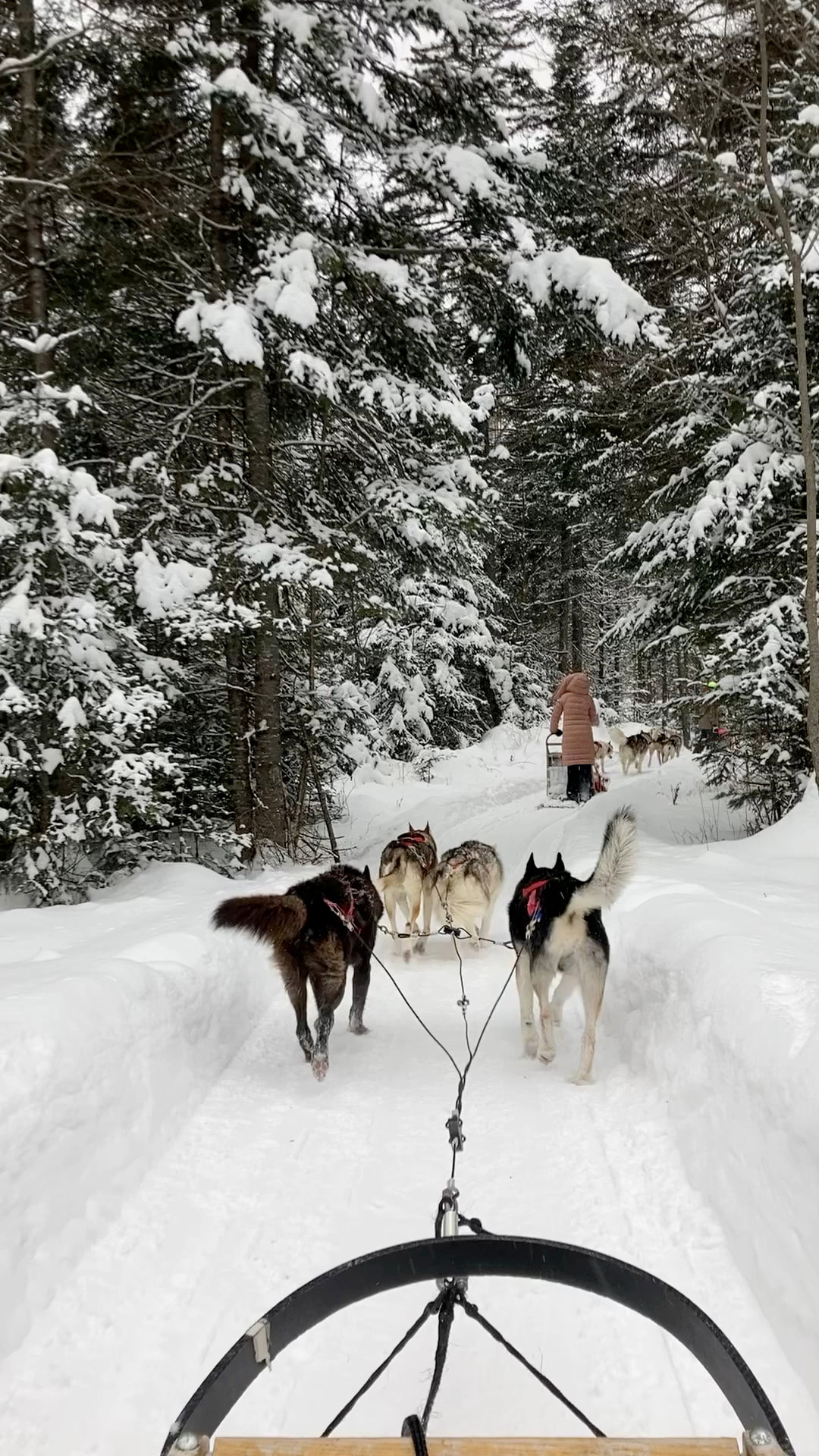
To be fully honest with you, I profoundly dislike winter. I hate being cold, wearing so many layers that you feel like the Michelin man and weight twice as much as you usually do, having to shovel your driveway twice a day, walking on ice or in sludge for 3 months, etc. But, having lived in Quebec City almost all my life, winter is part of the deal and I've had to find somethings to like about it. I have to admit that winter has a way of making some destinations just a little bit more magical!
As most people in Quebec would say, there is no bad weather, the are only bad clothes! Honestly, winter here is pretty harsh and you need to be dressed appropriately, but otherwise, it can. be a lot of fun. I hope you get the chance to explore the region of Quebec City in your travels.
other articles you might enjoy
When I discovered that I liked traveling... a lot...too much? I decided that I would start by visiting my Canada. Starting elsewhere would have felt like cheating. Kind of like taking my own country for granted. Everywhere we go, people tell us how lucky we are to live in Canada and they are right. Canada is freaking beautiful! So I left to work on Vancouver Island and spent the year visiting British Columbia and Western United States before driving across North America to go back home to Quebec City.
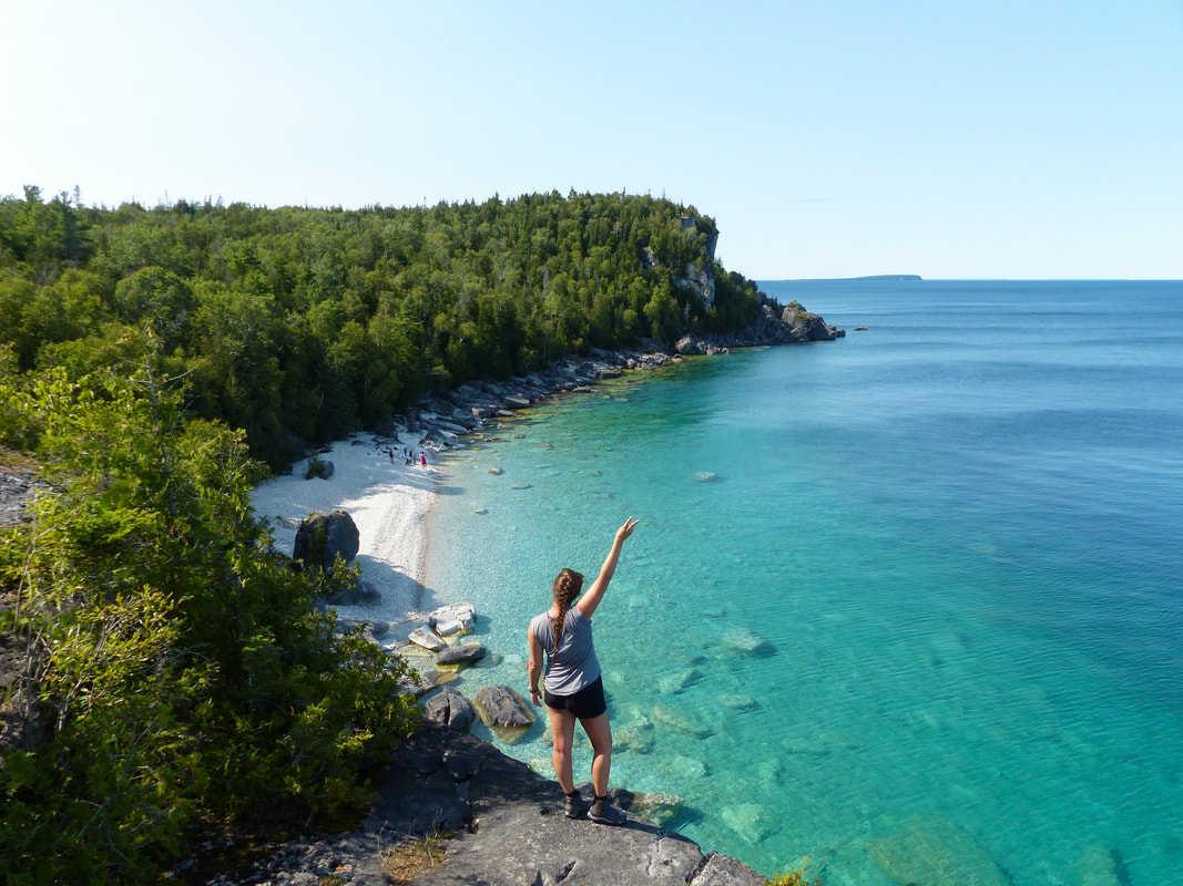
Then, I felt ready to explore a bit further from home. I went to Costa Rica, Morocco, Italy, and then BAM! Covid-19 hit and we weren't allowed to cross the borders for an unknown amount of time. The thing is, when you start traveling, it is kind of like a drug, it's very hard to stop once you're addicted. So I went back to visiting my old friend Canada and decided to discover a little corner that I had never explored: the Bruce Peninsula, a small strip of land separating the Georgian Bay from Lake Huron in the south of Ontario. Internet promised me Caribbean blue water, long and peaceful hikes and a ton of water activities. It's kind of hard to say no to that! 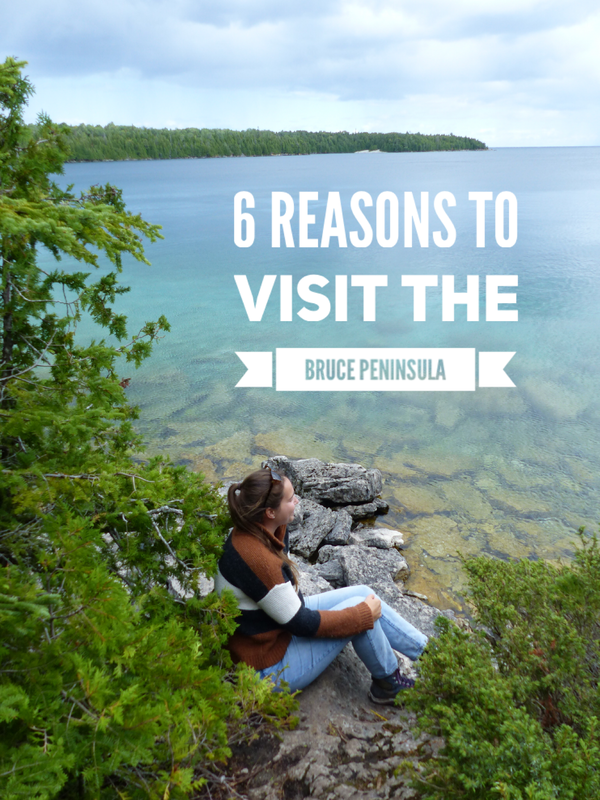
My friend wasn't very hard to convince and a month later, we were on our way to Ontario on a 10-hour drive from Quebec City to this new adventure. I'm pretty sure the pictures will make you want to visit this area of Canada, but just in case you need more convincing, here are 6 reasons you should head to the Bruce Peninsula.
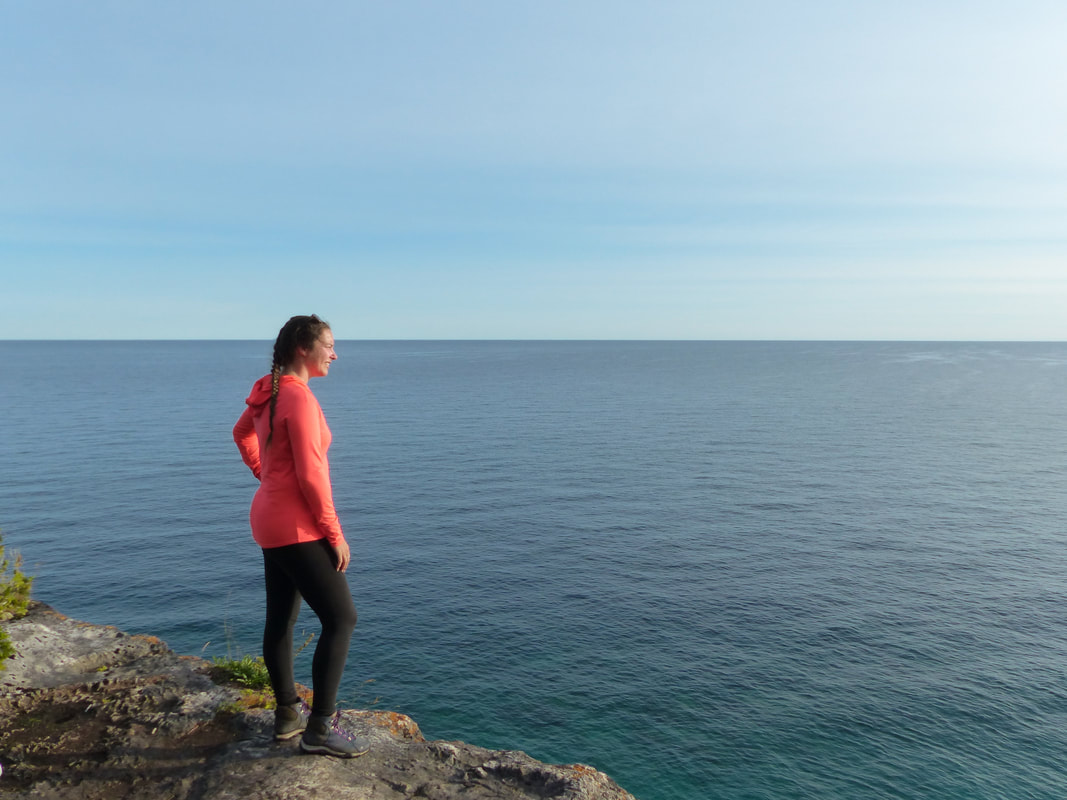
1. the beauty of the landscape
Let's start with the easiest reason, but gosh can this landscape get any better? I have been back from this road trip for a while now and still can't get over it. You see it on pictures and you have a hard time believing the water can be this blue in real life, but it totally is. Not only is it a bright turquoise, it is so clear you can see all the way to the bottom even when it is meters deep. All along the coast, you discover little bays that are all prettier than the last. Hiking trails will lead you past viewpoints where you can admire the view from the top of cliffs, rocks covered in green moss, clumps of colorful mushrooms, fields of wildflowers, etc. And let's come back one more time to the color of the water because it deserves to be mentioned a second time. My friend and I spent the whole time saying it looked like we had just been transported to the Seychelles, or the Caribbean, or an island in Thailand. The fact that this is in Canada just blows my mind!
2. the number of activities on offer
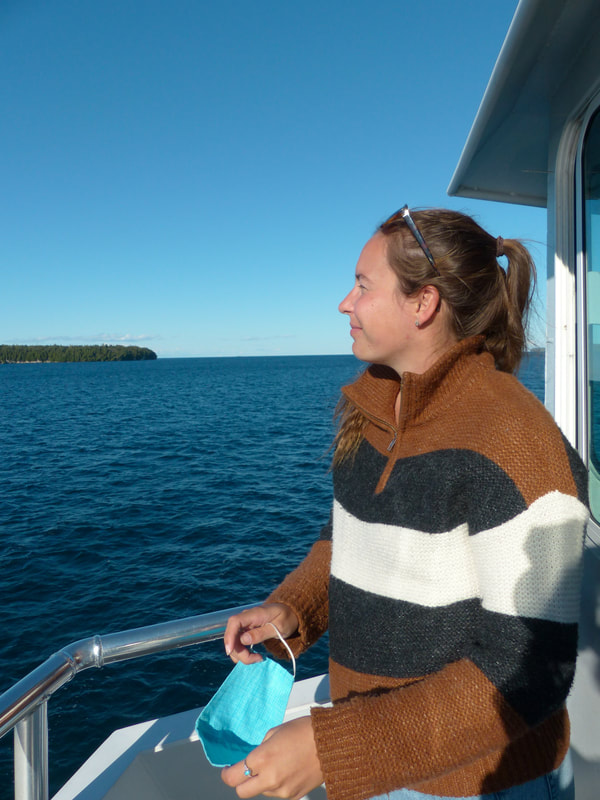
For someone who loves the great outdoors, there is plenty to do in Bruce Peninsula. Kayaking, paddleboarding, snorkeling and diving (yes there are two shipwrecks where you can dive and many underwater grottos), hiking, beach days, sailing, swimming, there is something for everyone. You can also go on a boat ride with a glass floor around the islands, go fishing, camp, etc.
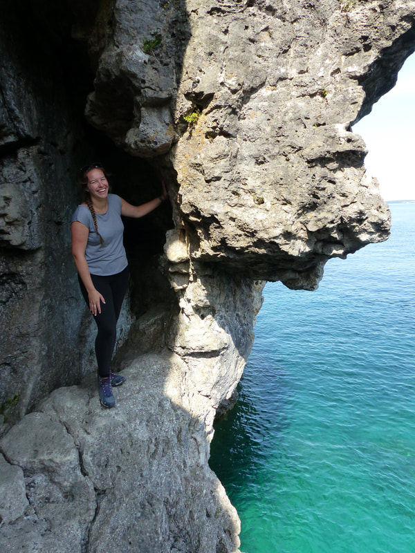
3. the hikes
The peninsula is almost completely part of the Bruce Peninsula National Park which means there are lots of hiking trails that are well maintained and mostly well indicated. For experimented hikers, the Bruce Trail is a more than 800 km trail from Tobermory, at the end of to peninsula, to Niagara. It offers incomparable views on the Georgian Bay and its islands. Beginners can do parts of the Bruce Trail or one of the many others on offer in the park. There are also trails suitable for families with strollers or people with a handicap that lead to easier to reach viewpoints. For most parts of the trail, I recommend good hiking shoes and to bring a map with you. There can be some steep hills, but it is totally worth it.
4. the simplicity of the destination
Traveling in your own country is of course always easier as you don't need to worry about insurance, exchanging money and things like that, but even for people from other countries, the Bruce Peninsula would be an easy destination. It can be reached by bus from Toronto and you don't need reservations years in advance or to make tons of research. I recommend making reservations for your accommodation once you find out the days you will be traveling, but we booked just a few days before our trip which was during a long weekend in the first summer of Covid when Canadians from the cities flocked to national parks and we didn't have trouble finding a place to stay or booking activities on site. It's a pretty stress free vacation since there are always many other options if what you wanted to do ends up being full.
5. the number of visitors
Like I said earlier, the year we visited was particularly crowded because of Covid, but even then, we found once we started hiking, we were totally alone and barely crossed paths with a few other people. The park is so huge and there are so many different areas that, if you feel like it's crowded where you are, you can just go a little bit further down the path and you'll be completely alone. The only place that we found crowded was the grotto, but even that, the parking lot is so restricted, it never really gets busy. I think that even in high season, it would be a good destination if you need some time surrounded by nature without the distraction of other humans.
6. the sunrises and sunsets
Sunrises and sunsets are moments that I talk about often and that I try to plan for while on vacation. I organize my schedule to make sure I will be in a good spot to watch at the exact point in time where the sun meets the horizon. I loved the fact that, being surrounded by water, the peninsula offered both great sunrises and sunsets over the water of Lake Huron. We were lucky enough to get a full on spectacle every morning and every night during our 5 day trip.
So wether you are looking for breathtaking landscapes, activities to do with your friends and family or if you want to spend some time in nature, the Bruce Peninsula is waiting for you. Enjoy your visit!
other articles that might interest you
25/7/2022 0 Comments SWIMMING IN THE VIRGIN RIVER
I absolutely loved the road trip I went on with my friend Karine in Utah, Nevada and Arizona. These states are gorgeous all around with their mountains of red limestone, deep creeks, deserts as far as the eye can see and narrow canyons, but, in September when we went, it is HOT. In some parts, it is scorching.
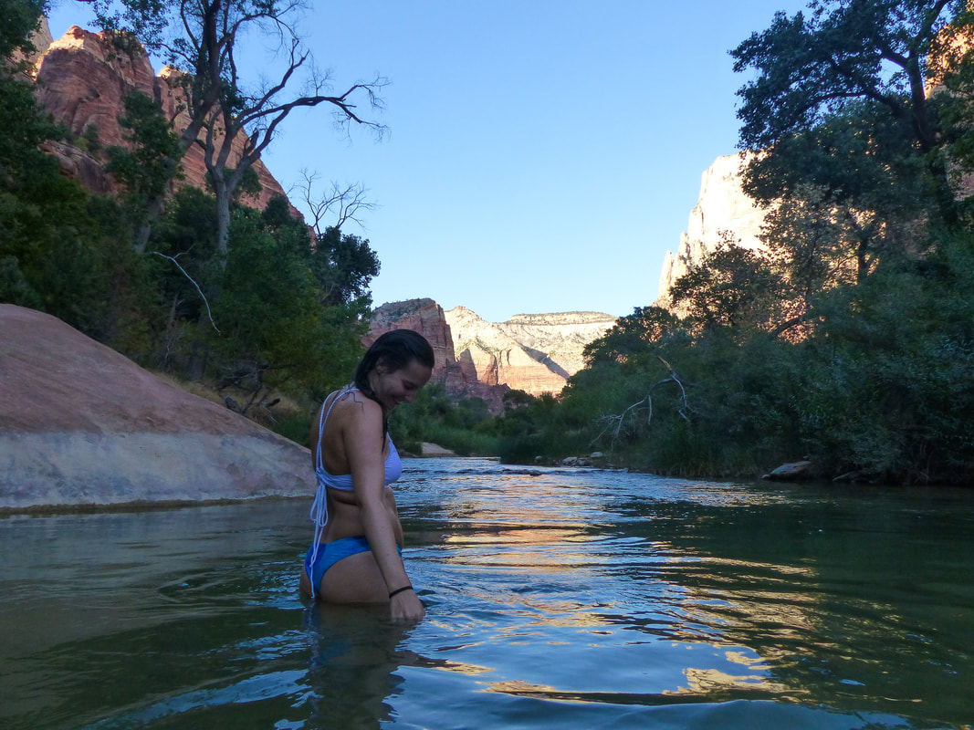
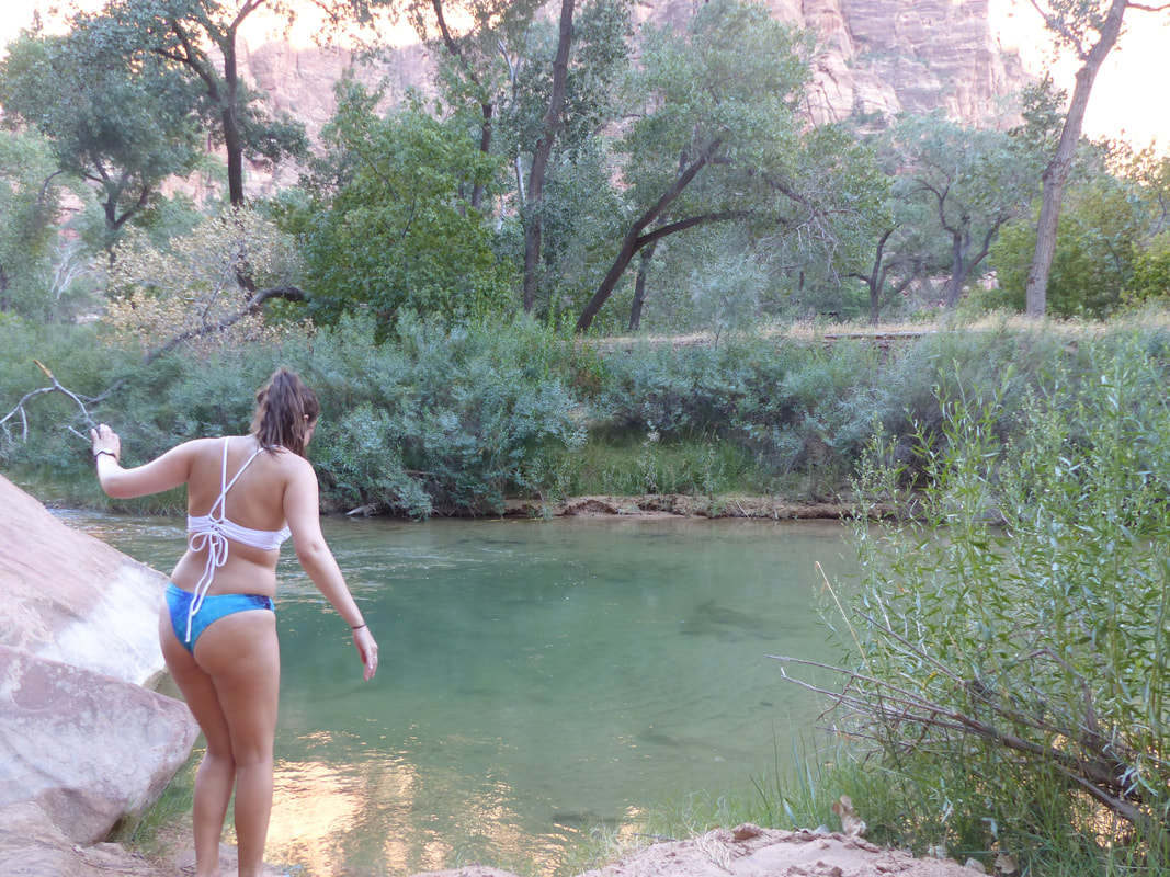
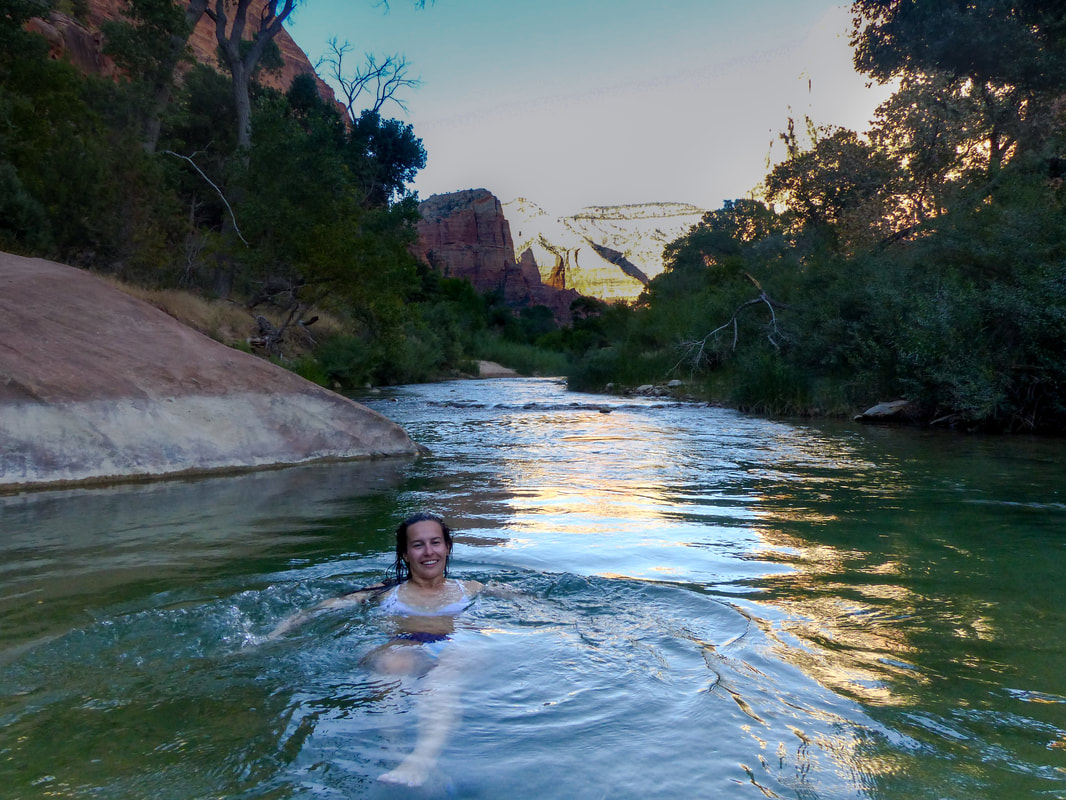
On the second day of our road trip, we were hiking in the Valley of Fire State Park in Nevada before driving to Zion National Park in Utah. We started early as we knew it would be hot. I had intentionally chosen small hikes so we could slowly get used to the heat as, being from Canada, we are not used to this. The two hikes were about 30 minutes each, but after the first one, I could feel myself getting dizzy and dehydrated even after drinking from my water bottle every two seconds. As a lifeguard and having lived in Florida before, I can recognize the signs of heat exhaustion and this was it. We took a break before deciding to do the second hike. We stayed in the shade, drank cold water from our refrigerator, ate fruits and veggies and salty snacks and we were both feeling good enough to go. And it was so worth it as the view on the deep red and orange mountains and valleys took my breath away. We then started the drive to Zion with the air condition bringing as much relief as possible from this heat. Unfortunately, as soon as we started going up a hill, the engine was not strong enough and the air condition would stop. Let's just say that when we arrived in Zion at about 4PM we were both sweaty and exhausted, but excited to be there. Zion is also a lot cooler than Valley of Fire and, as the sun was starting to hide behind the mountains surrounding the canyons, we felt a huge relief. Unable to resist getting a first glimpse of the canyon, we both put on our swimsuit under our clothes and headed to a small trail called Lower Emerald Pools, with the intention of going for a swim in the river afterwards. We took the shuttle and exited at Zion Lodge, crossed the bridge and started walking on the easy path. On the way, we noticed tracks heading to a small beach by the river and called it: if we were to swim in the river today, this would be the perfect spot. A huge boulder hid a small pool from the current and the bottom looked sandy and soft.
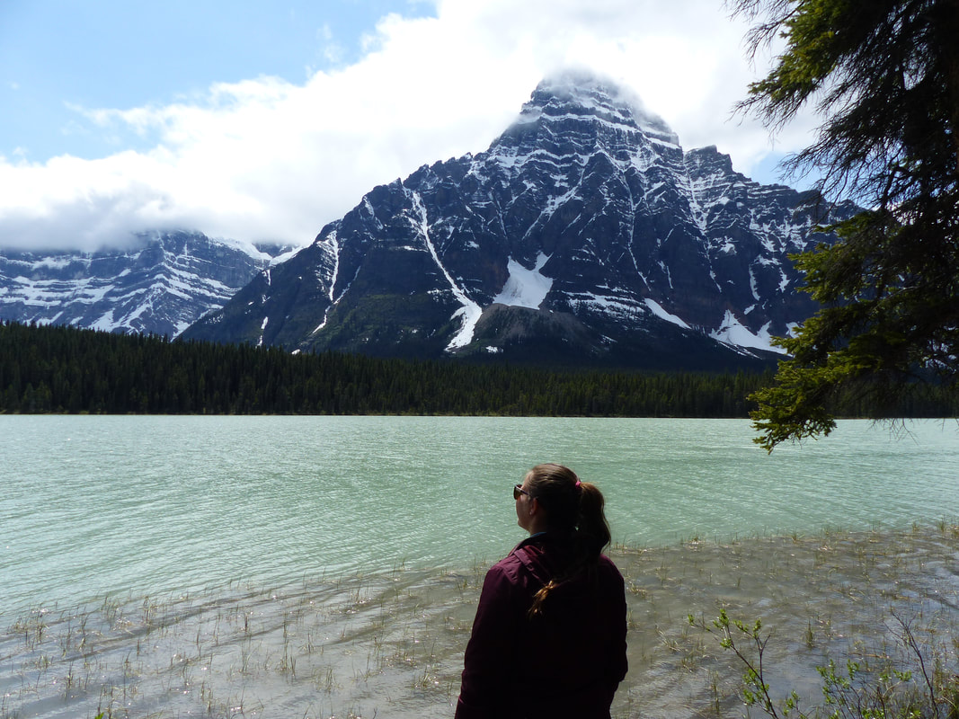
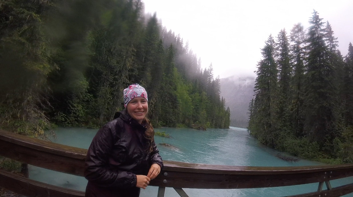
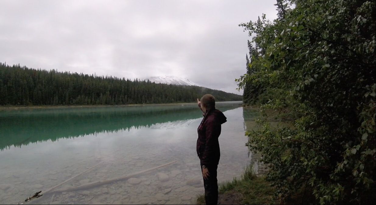
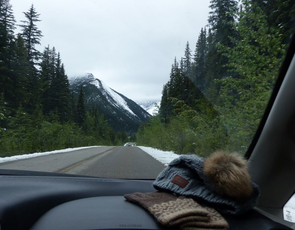
The next day, we were driving to Jasper in the same weather, only to get to the village where it was snowing like Christmas Eve. Our plan of camping was quickly thrown out the car window and we were lucky to find a room in an airbnb in the village. When we woke up the next morning, there was still snow on the ground and we still could not see the mountains as we made our way to Five Lakes trail, but at least it wasn't snowing or raining anymore. During our walk along the trail, as the wind shifted the clouds, we could see the silhouette of the enormous mountains surrounding us, but still no luck seeing the summit or getting a clear view.
It turns out that we worried all for nothing as the very next day, as we were driving through the Icefield Parkways on our way to Banff, the sun finally came out and we enjoyed two days of clear blue sky and enough mountain views to last me a few years.
When we started planning our trip to Morocco, my friend said to me: We need more nature and more hiking on this trip. Well, the highest mountain in North Africa is luckily located in Morocco. Since there were expeditions of a few days combined with stays in the Sahara, we jumped at the occasion. Let me tell you we had no idea what we were getting into, but I'm glad we did it. As John Green wrote in Paper Towns: "If we don't die, this is gonna be one hell of a story". Well, here is the story!
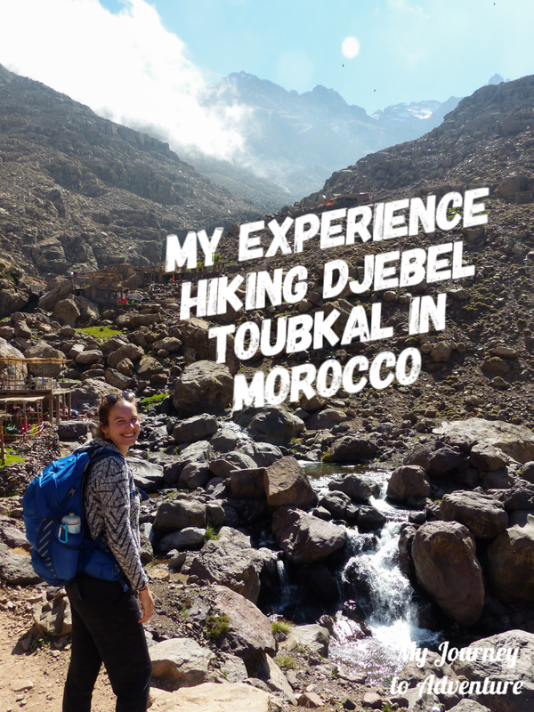
To start, let me tell you a little bit more about the tour we had booked. We purchased a five days, four nights expedition out of Marrakech with a group from two to twelve people. Since there were already two of us, we knew for sure the expedition would not be cancelled even though we were visiting in October, during low season. We were to spend two days on the Toubkal, two days in the gorges on the way to the Sahara, one night in the desert in Merzouga and then one day on the road back to Marrakech. We had seen some longer treks up the Toubkal during our research, but since we had a limited time in Morocco, we decided on the shorter hike that would still take us to the top. We ended up being the only ones in our group. Although there were other people on the mountain, we were by ourselves with a guide and chef/person that leads the mule up the mountain.
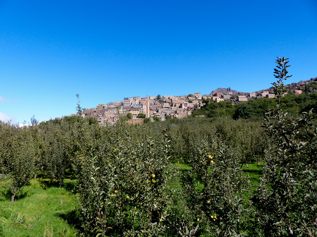
The day of our departure for the Atlas, I woke up to see my friend had an eye infection. Her eye was barely opening and bright red. Not the best way to start a two day trekking journey up the highest peak in North Africa, but she decided she still wanted to go and would just put some cold water on it and wait after the hike to see if she needed medical attention. So a driver came to pick us up at the riad where we were staying in Marrakech and drove us to the small village of Imlil, about au hour away from Marrakech. In Imlil, we were greeted by Jamal, the owner of the company we booked the tour with, who explained the road up the mountain and the different steps of our journey. He introduced us to Mohamed, our guide, and Abdou, the chef. After the traditional mint tea, we were grabbing our backpacks and starting our ascension to the top of Toubkal.
On the first day, we were to climb 11 km to the Base Camp, also called "Les Mouflons", at 3207m of altitude, where we would spend the night. At first, it was a walk in the park. We were slowly going up and the view on the mountains and the little villages was beautiful. We stoped after about an hour and a half to take a sip of water and enjoy the view. After about three hours, we stoped for lunch at a little hut where we ate on the balcony in the sun. There was a Tajine of course, but also different cheeses, some traditional bread, vegetables and fruits. Everything was delicious and we had to stop ourselves from eating too much.
After lunch, we still had a way to go to get to base camp and, honestly, I was getting tired. We kept going up on a rocky path and I guess the altitude was starting to get to me as every step felt so hard. From the moment we first saw the camp, which is a huge building built out of rocks, it felt like it took a whole hour to get there. But we finally made it and were able to talk to other hikers and sit down to relax with a nice cup of mint tea before dinner. I was so tired that I was barely able to eat some fruit and some bread that night. The moment the sun set, I was ready to go to bed! 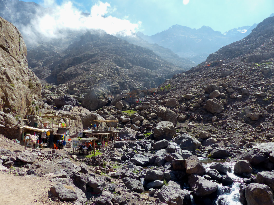
Unfortunately, I didn't have a restful night. With the time difference between Canada and Morocco (this was our second night in Morocco after landing the day before) I had trouble falling asleep. It was also pretty cold in the camp and the beds were giant structures that went the whole way along the wall, which meant we were sleeping in the same bed as a dozen strangers. Nothing to help you get a good night of sleep.
I had barely fallen asleep when Mohamed came to wake us up at 2 AM. We wanted to make it to the summit for the sunrise, which meant a very early morning start. Luckily for me, even after no sleep at all, I felt energized after the delicious breakfast. 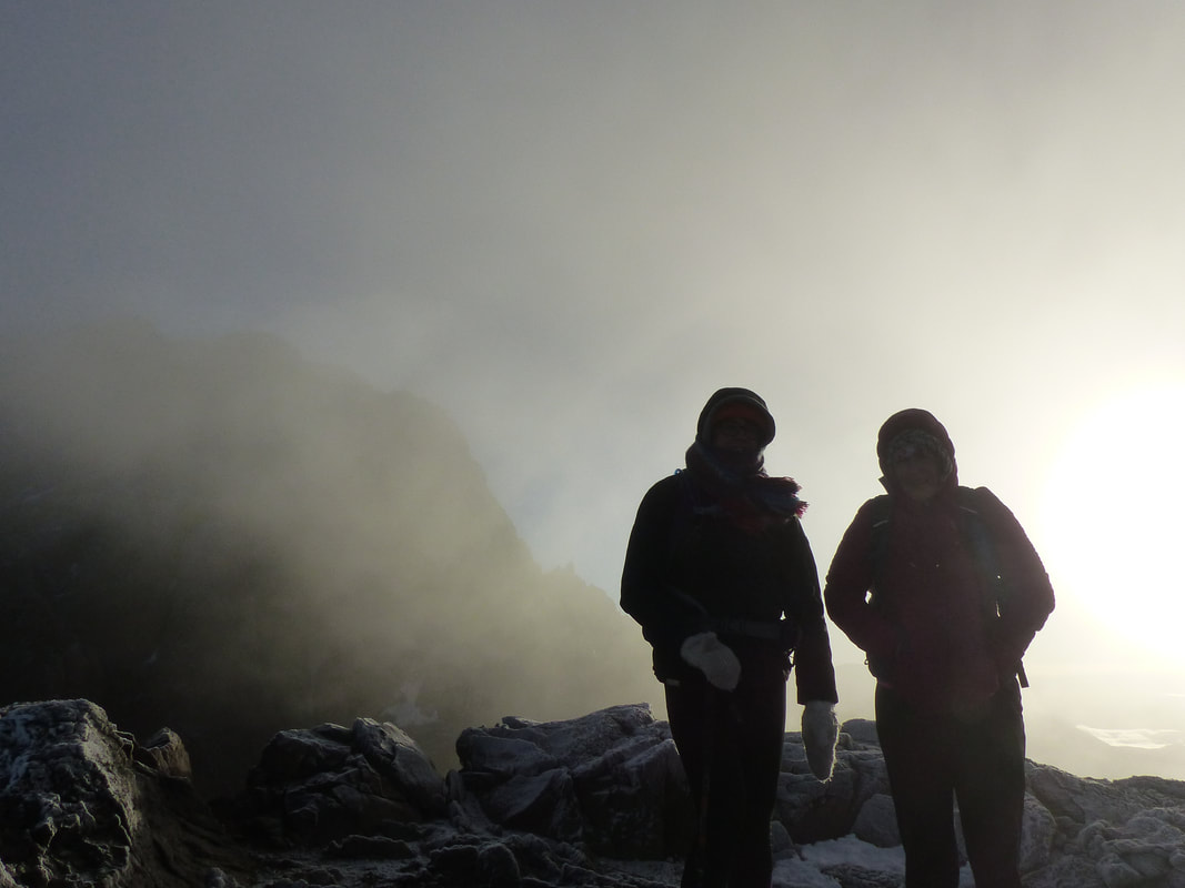
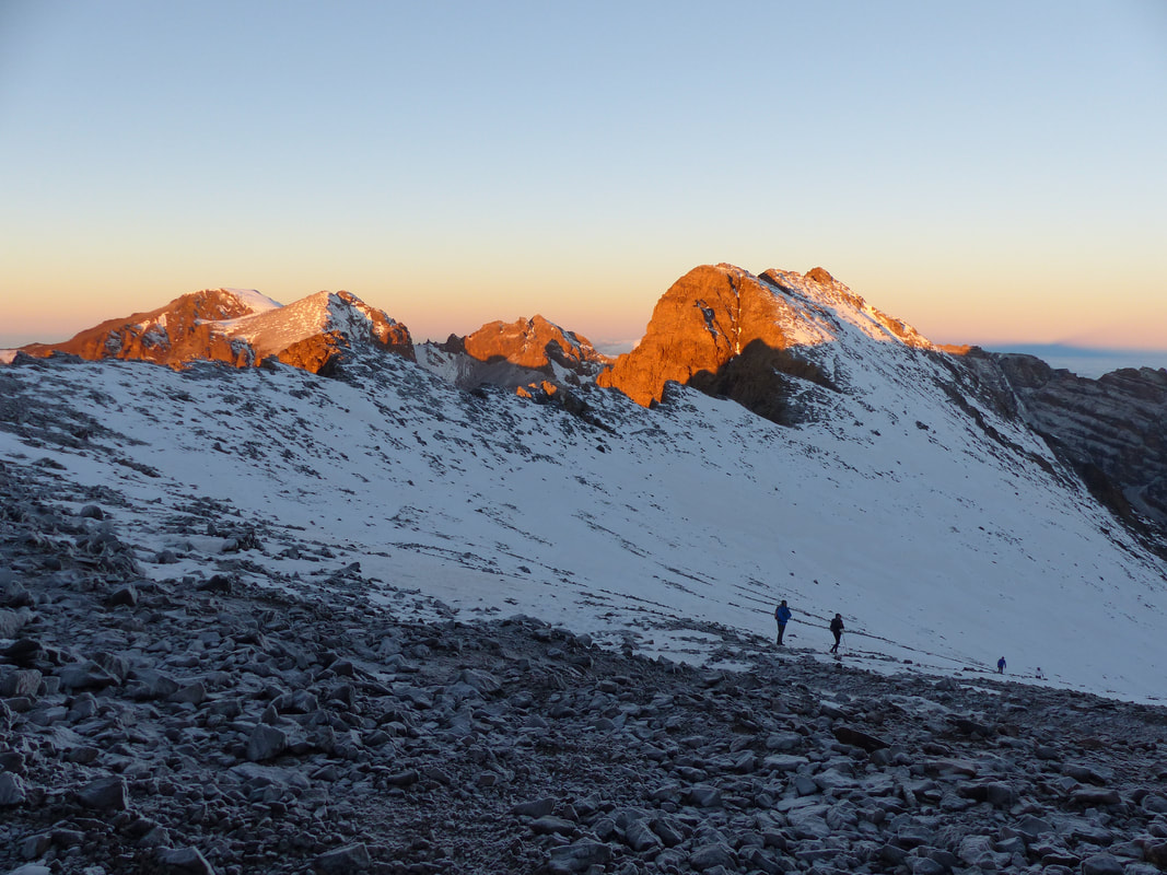
When we stepped out the door, we were gobsmacked by the view. First, it had snowed during the evening and everything was covered by a thin blanket of white dust. Being from Canada, that's not what impressed us though. There were absolutely no clouds and no light pollution and we could see the stars. Now, I know what you are thinking: young lady, you can see the stars from anywhere on a clear day, what's the big deal? Here is my answer: you have never seen the stars like this! There were thousands of them and we could see them so clearly! Being so high up in the mountains, it felt like we were surrounded by stars. I can't even describe it correctly, but even in National Parks I had never seen a view like this one and I haven't seen anything like it since. I wish I had a good picture, but we didn't think to take one and, even then, it would never do it justice.
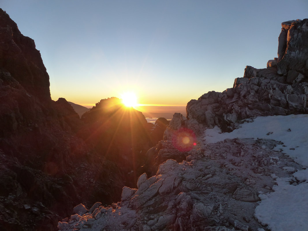
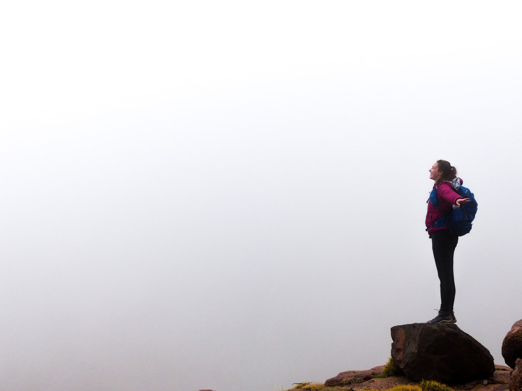
We started making our way to the summit, across rivers and over boulders. My friend was having some difficulties with the altitude, but compared to the day before, I felt absolutely fine. Now, there is one thing I was not expecting. We had been told that it would be about 0 degrees Celsius on top of Toubkal and we had expected it to be a little colder until the sun came up. We both had a coat (although not a Canadian winter coat), long pants, gloves and a hat and it was fine at the beginning, but after a while, the wind came up and it had to be at least negative 15 degrees. At least! It was freezing! And let me repeat, we are from Quebec City, the temperature can go down to negative forty in January and I am still alive to talk about it. We are used to cold weather. This was whatever comes after cold! But we had made it this far, so we pushed through and kept going. On the way up, you reach a point where you have to wear crampons over your boots as it is snowy and icy and slippery. You have to watch your step and, every step you make, you slip down halfway. After hiking for hours, we finally reached a plateau where we could see the sunrise. I would love to say, at that moment, that the whole struggle felt worth it, but to be honest, I couldn't feel anything. I was completely frozen and, although the view was absolutely, ridiculously, beautiful, I couldn't appreciate it at the time. My friend was a few minutes behind me and when she made it up to where I had stoped to watch the sun rise over the horizon, I could see on her face that she thought the same thing. But we weren't on the summit quite yet. We had about half an hour left of climbing to reach it, so we started walking again.
I have no idea how long we kept walking. All I remember was seeing the summit and seeing clouds rolling in and knowing that even if we reached the top we wouldn't be able to see it. I remember thinking that with the wind, it was getting dangerous. And my friend and I looked at each other and we both knew that this was it. One kilometer to the summit and that was it. We were going back down. Reaching the summit didn't matter anymore. We were exhausted, we were cold, we had seen the sunrise and this was over.
Now over a year later, I still don't regret it. Reaching the summit wouldn't have given us anything more than what we had at that moment. It wouldn't have made us prouder of ourselves. We wouldn't have had a better view or a bigger sens of accomplishment. To this day, I still consider that we made it. But we also made it back down safe and sound and with all of our limbs which is really what matters here. 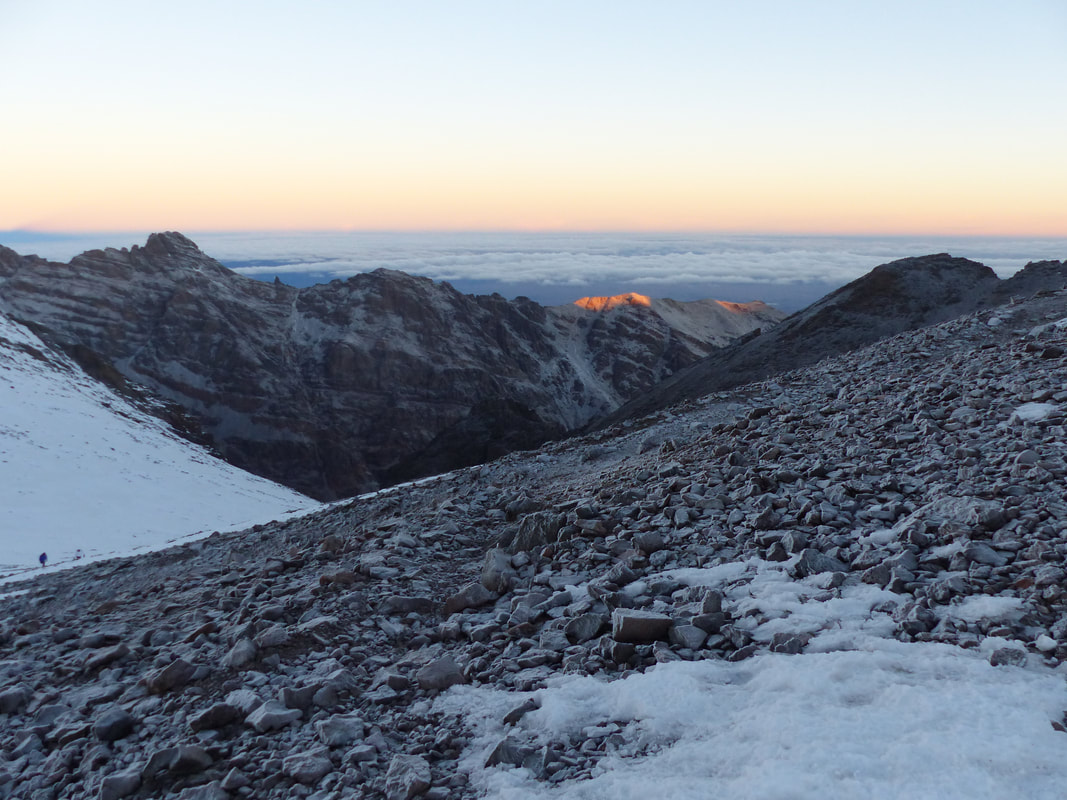
Deciding to turn back down is one thing, but it doesn't magically transport you to the base of the mountain. It doesn't erase the cold or the tiredness. We still had to walk all the way back down the mountain.
The walk back to camp is another thing that is blurry in my mind. I remember being so cold that I almost ran down the mountain. I remember stoping for a break because I felt nauseous and sitting down until our guide came up to me and said I had altitude sickness and we had to keep going down, this was the only way to feel better. Apparently going up too fast is not a good idea, but going down too fast isn't much better. Then I remember walking into the refuge and asking if we can take a nap because I felt like crap. I think we slept for maybe an hour, but I felt better afterwards and was able to eat a light lunch. 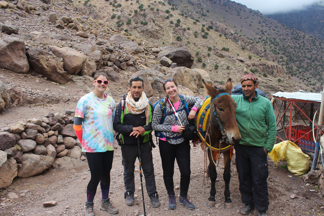
After lunch we slowly made our way down back to Imlil and every step we made I felt more and more like myself. The nausea disappeared, the tiredness was more tolerable, I felt lighter and overall way better. Altitude is no joke!
The last two or three kilometers though, were very hard. My knees were hurting and we were both tired and just wanted to get there and get some rest, but we did make it. We were welcomed at Jamal's house with mint tea that had never tasted so delicious. We had a feast for dinner and had our own room for the night where I got the best sleep of my life. My friend did end up having to go to the doctor for her eye infection that had not disappeared and was actually getting worse and both of my knees ended up swelling pretty badly. One of them I could not bend for about five days. But, even after everything we went through, I still believe it was worth it. We got to talk to our guide ant learn so much about the berber culture and life in the Atlas. We saw some gorgeous views and in the end, we had fun! 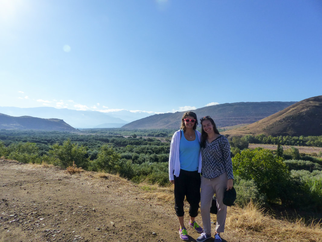
After living through this adventure, would I climb the Toubkal again? I don't think I would do this again. Once was enough. Was it worth it? Definitely! You never know how you are going to react to being challenged like this and I am proud of myself for going all this way and making it so far. Do I want to hike another mountain after this one? Of course! I would love to hike to Machu Picchu and I would love to try to Kilimanjaro, but next time, I will bring clothes for any weather, even if it is supposed to be warm. Next time, I will plan it in advance and actually train for it. Next time, I will know what to expect. Let's do this!
other articles you might enjoy
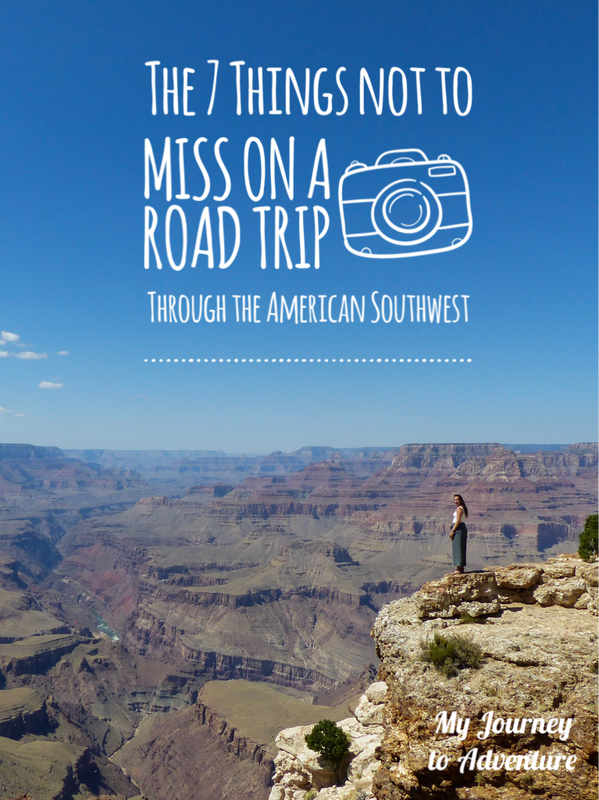
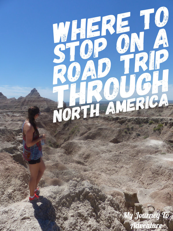
North America has a lot to offer to travelers, especially the ones who enjoy nature. I consider myself lucky to have explored it from coast to coast, but there is still so much to see. One of the regions I had not visited yet was the American Southwest, home to canyons, deserts, cacti and so much more. In September of 2019, one of my friends and I set off out of Las Vegas on a two-week road trip through the red rocks and arches, going from National Park to National Park. Here are some of the places I think everyone travelling through the area should visit.

1. Zion National Park
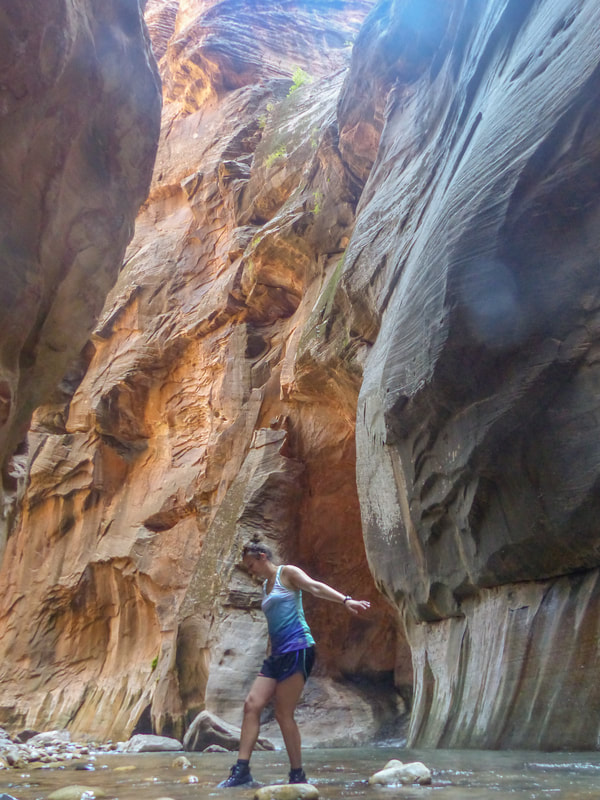
I listed Zion as number one, not only because it was one of our first stops, but also because it was my absolute favorite. The narrow canyon, rough hikes, clear turquoise river and incredible vistas did not disappoint. It is also home to my two favorite hikes of the whole trip: The Narrows and Angel's Landing. We spent two full days in Zion to make sure we had plenty of times for the hikes and also to take our time exploring the park and not overexerting ourselves in the heat. We also took a moment to swim in the Virgin River (if you want to know more about that particular experience, you can read ithere.) I loved the atmosphere in Zion. Even though it was crowded and felt squeezed between the canyon walls, it felt different from the other parks we visited. I guess seeing the canyon from the bottom probably gave a different perspective.
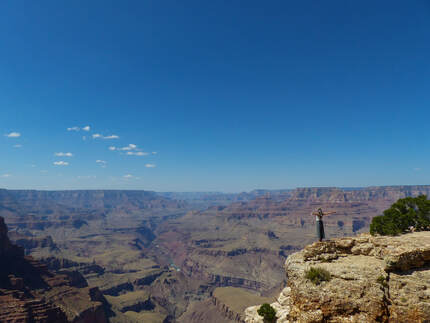
2. The Grand Canyon
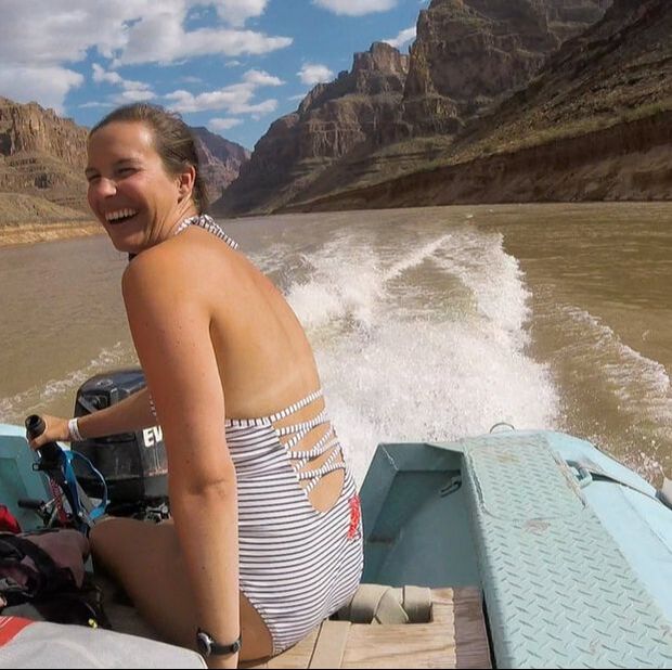
You can't visit the American Southwest without visiting the Grand Canyon. I mean, you could, but you would miss out on one of the most impressive feats of nature. We were incredibly lucky and, not only did we get to see the canyon from the rim, meet moose and walk around the rim at sunset, we also went rafting on the Colorado river, in the middle of the Grand Canyon! It was an incredible experience. The Canyon in itself is impressive and breathtaking, but to be in the middle of it showed me how small we all are compared to the immensity of this canyon.
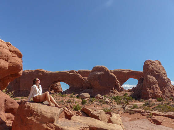
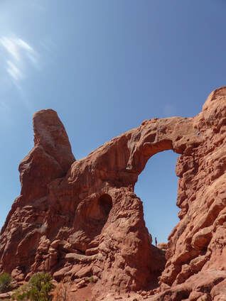
3. Arches National Park
Arches is a very small National Park compared to the other two, but it is definitely worth the visit. Not only does it offer beautiful views on the surrounding lands, but it is also home to more than 2000 natural stone arches! Isn't it amazing that these arches were naturally made by wind, water and sand over the years?
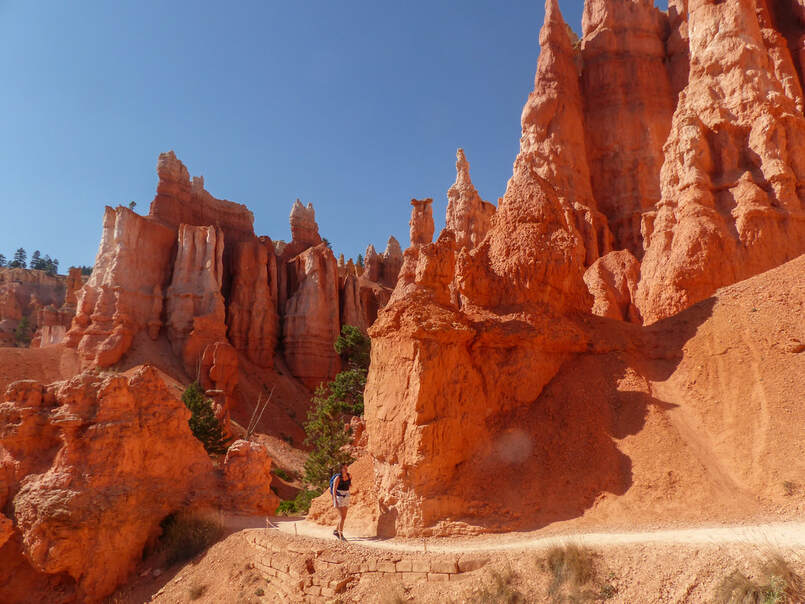
4. Bryce Canyon National Park
Bryce Canyon, like Zion and Arches, is located in Utah and is the home of the Hoodoos. You can walk along the trail that zigzags to the bottom of the canyon and see these stone spires from up close or watch them from the rim of the Canyon, but they still make for an impressive view.
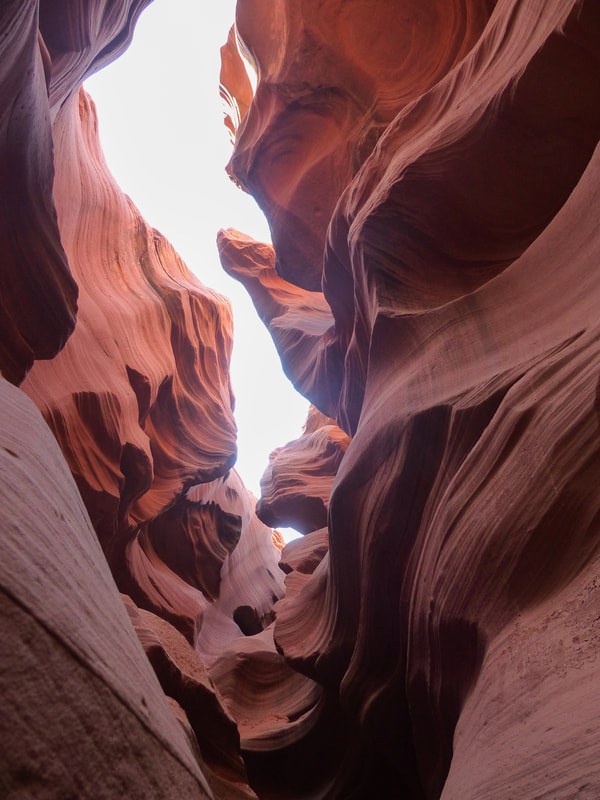
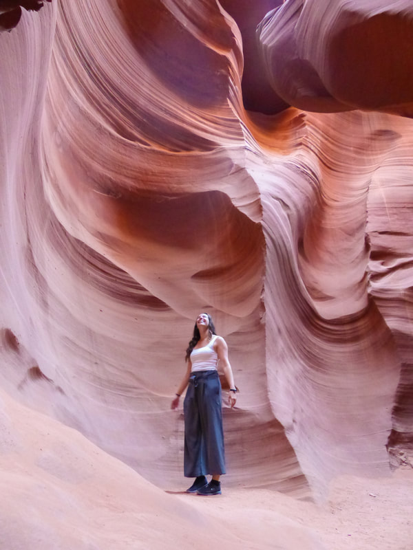
5. Anteloppe Canyon
You have probably seen the pictures of Antelope Canyon all over Instagram, but it's hard to imagine exactly how deep and twisted the canyon really is until you have stepped into it. It looks beautiful on pictures, but you cannot understand how much better it is in real life until you have seen it with your own eyes. The visit is expensive and time restricted, but having a guide with you showing you the particularities of every turn and giving you cues about the best spots for photos is really worth it.
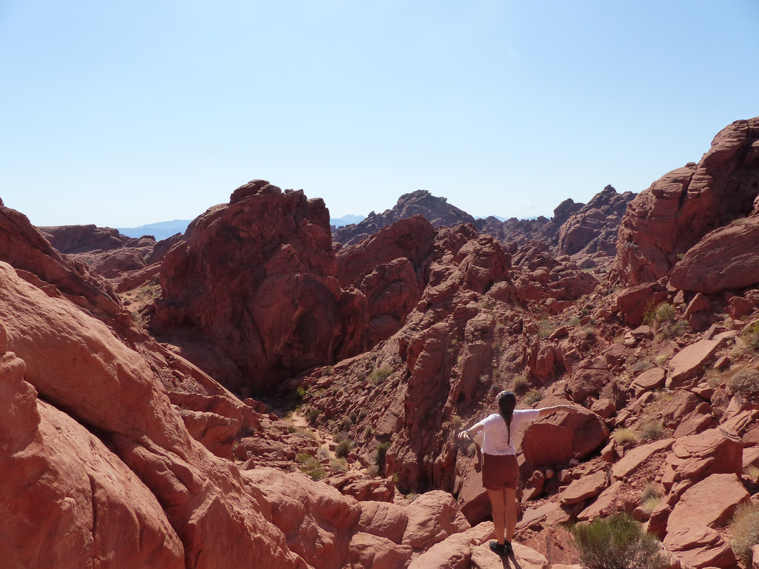
6. Valley of Fire
Valley of Fire was one of our first stops of this journey and I'm still not sure if the name is from the bright orange and red hues of the rocks or because the air is so hot it might actually burn you. Good thing the hikes were pretty short and we had cold water in the van because I am not used to this heat. But the different colors of the surrounding canyons and the enormous boulders made for an interesting stop and I would go again if I had to start the trip over. It was worth it!
7. Coral Pink Sand Dunes
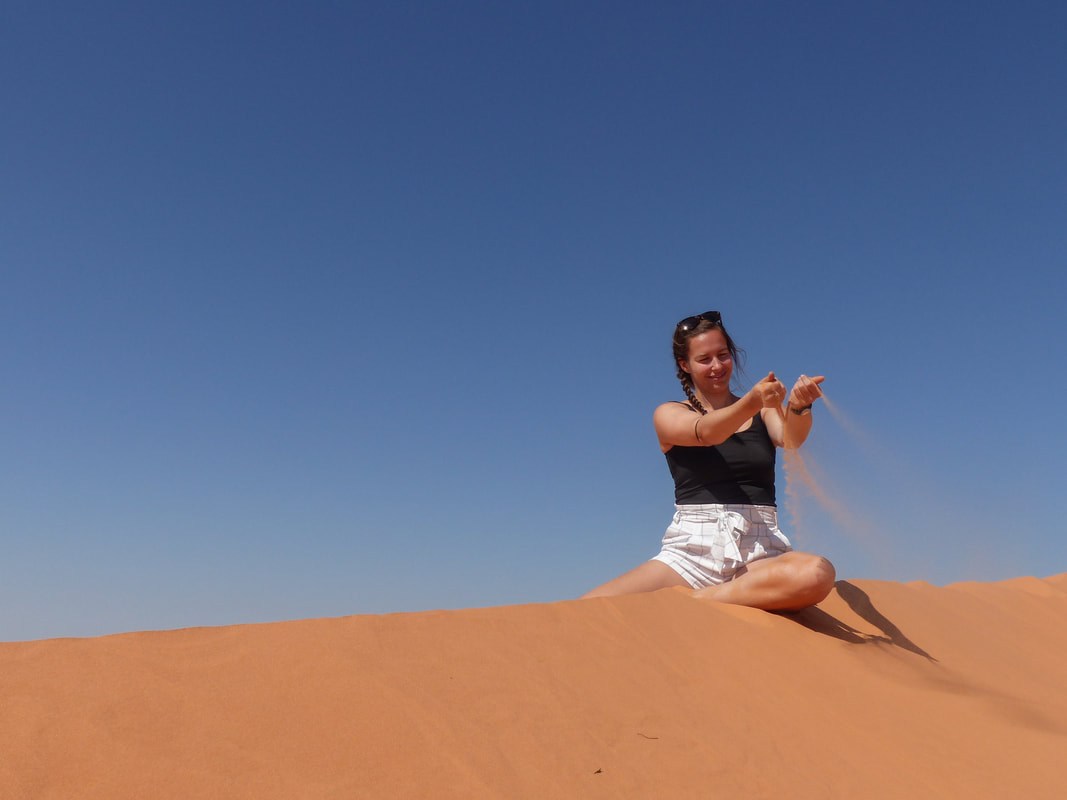
I know I'm no better than a 5 year old, but I still love playing in the sand. Especially this much sand! Coral Pink Sand Dunes is a very small park that only takes an hour to visit if you want to walk around the dunes for a while, which we did. It wasn't in our itinerary at first, but since it was basically on the way, we decided to stop by and I'm so glad we did. The dunes were about 10 meters high and the sand was a deep orange color that contrasted so well with the blue sky, my arts teacher could have used it as an exemple in 5th grade arts class. Plus, I love walking barefoot in the sand so I will always make a detour to visit a desert or a beach.
There are still so many places in this area that I wish to visit like The Wave and Havasu Falls, but I am very satisfied with our trip. Being in nature for two weeks, camping and taking our time was exactly what I needed at that moment. And filling my eyes and memories with so many gorgeous views was certainly a huge plus of this whole experience.
Have you been on a road trip through the American Southwest? If so, please let me know what you think are not-to-miss places. other articles you might enjoy
|


 RSS Feed